62 on Skye

May 22nd.

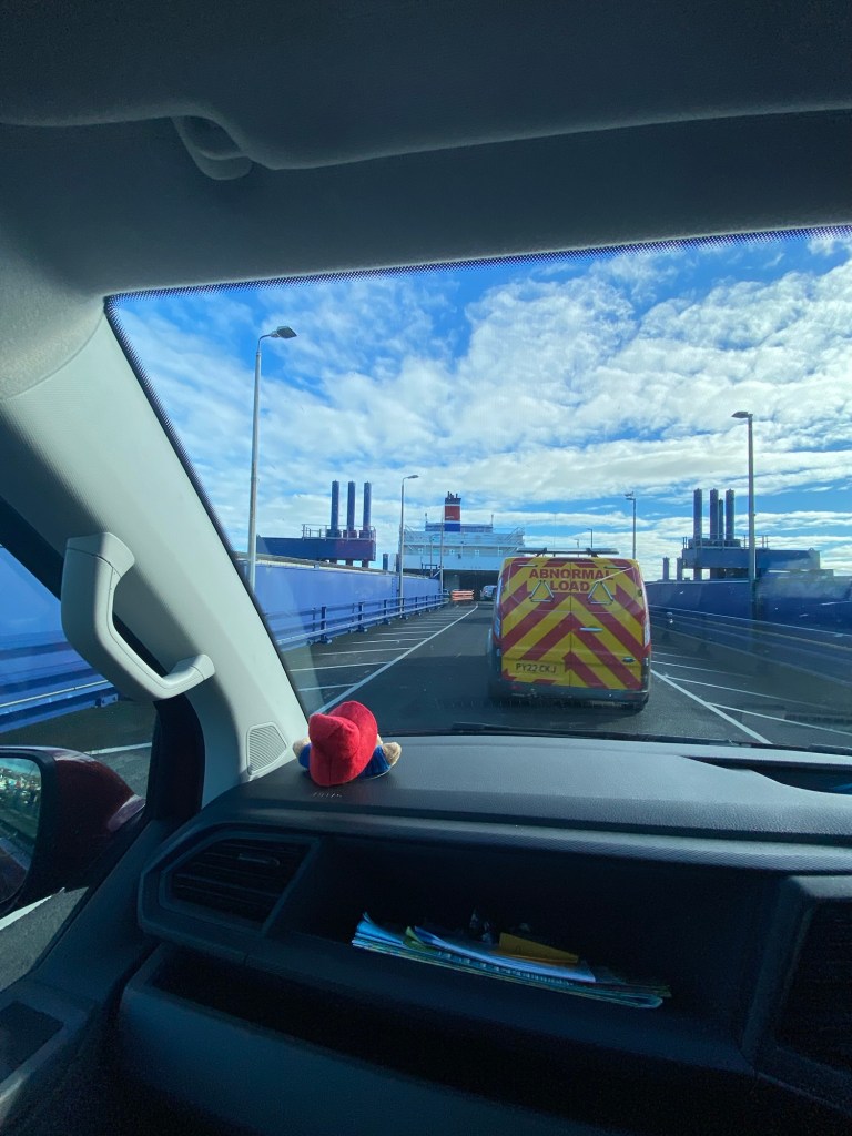
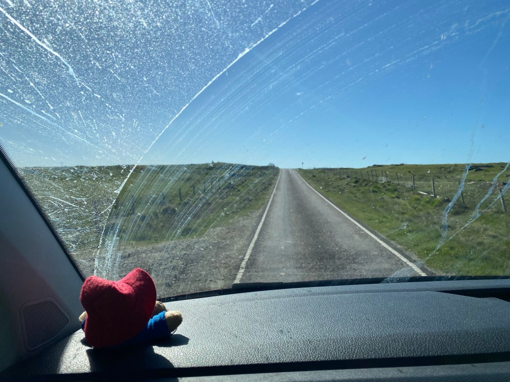
We woke up to another sunny day on Skye on my birthday. We had a nice morning writing and painting, and mid morning headed to Uig to get the ferry to Uist in the Outer Hebrides.

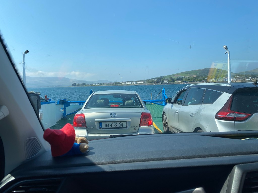
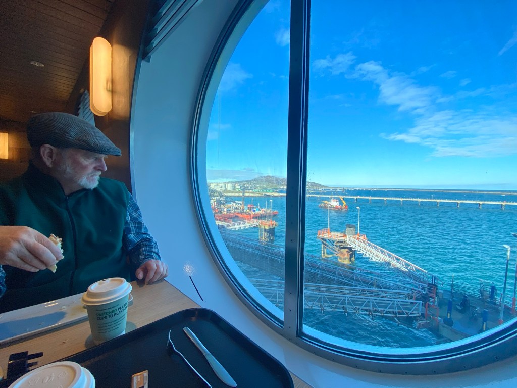
We had a bit of a wait so had birthday lunch out at a little tea house at the harbour.

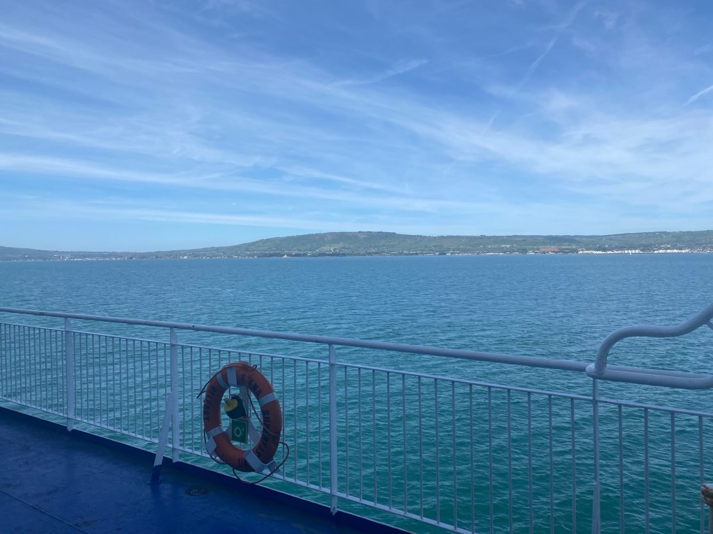
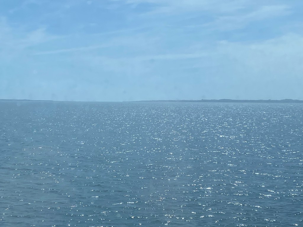
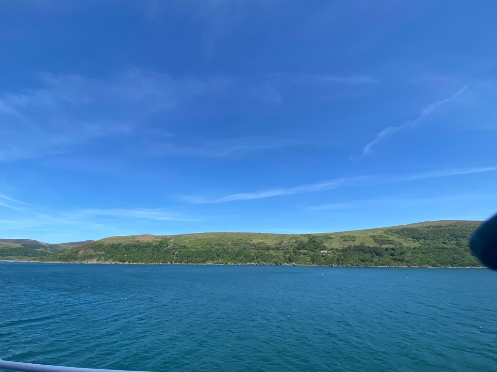
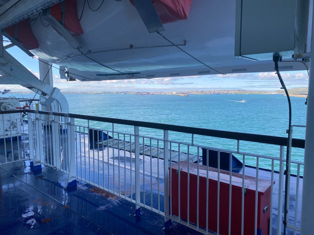
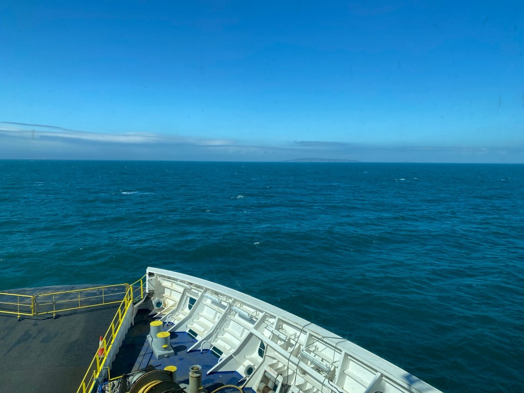
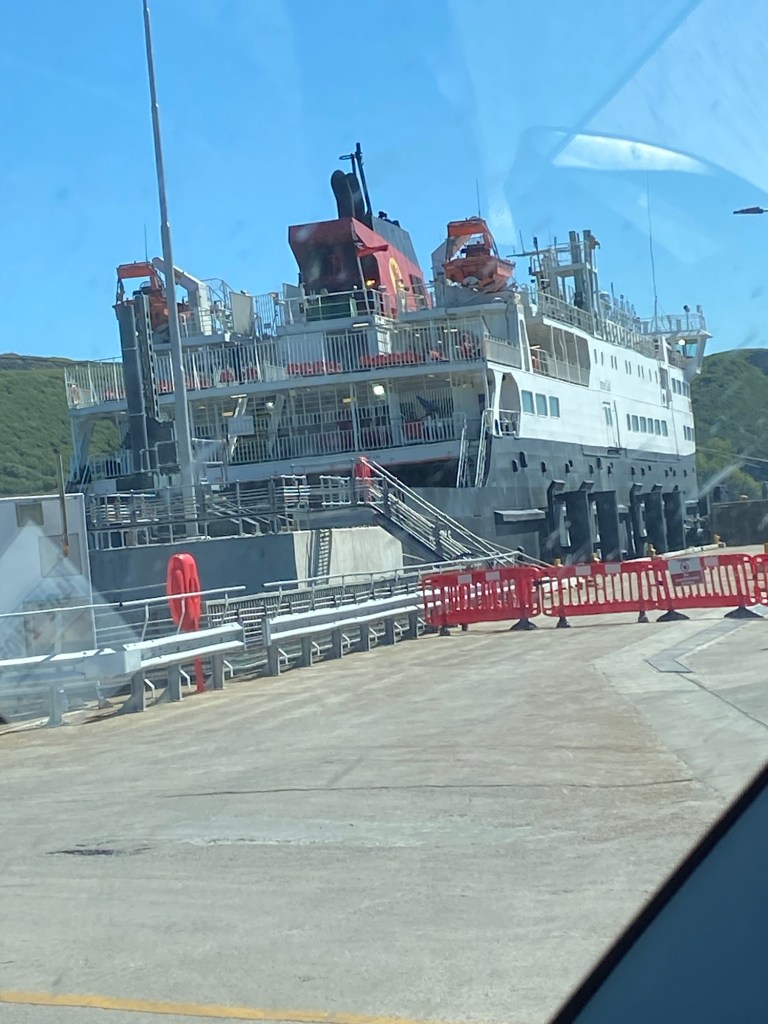
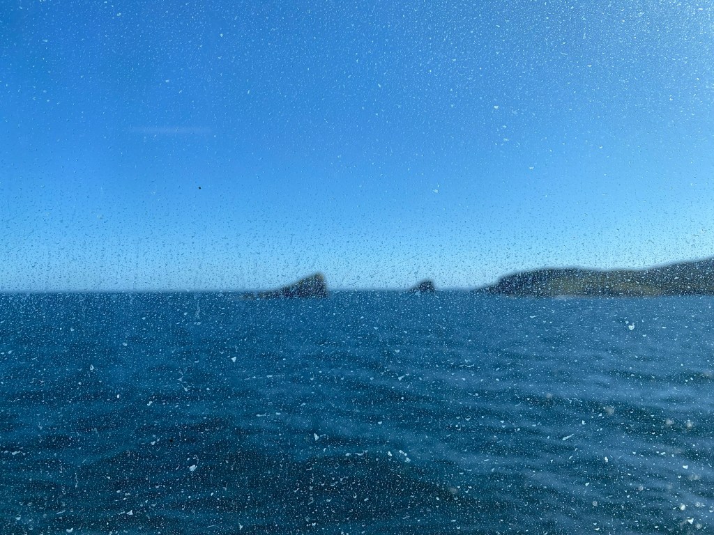
The boat was an 1 hour 40 mins across the body of water called Little Minch. It was a reasonably smooth sailing.

Our boat called MV Hebrides
A sweet dog looking at me.
Coming in to Lochmaddy on the Isle of Uist in the Outer Hebrides.
The 1/2 hour or so drive to the west side of the Island. Back to a lot of single track roads.

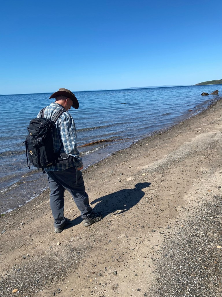
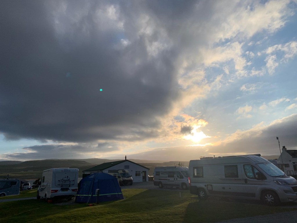
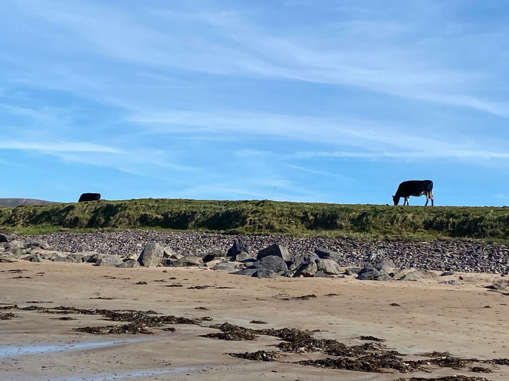
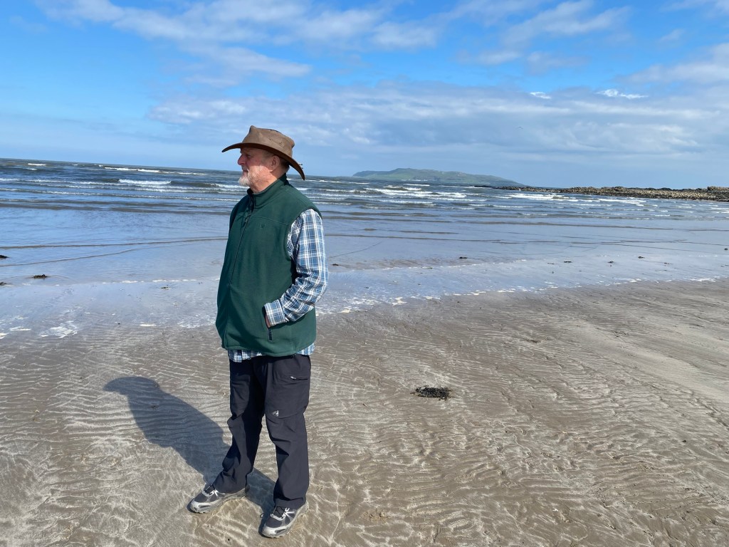
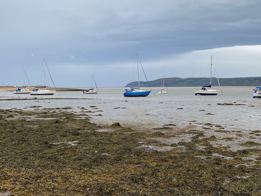
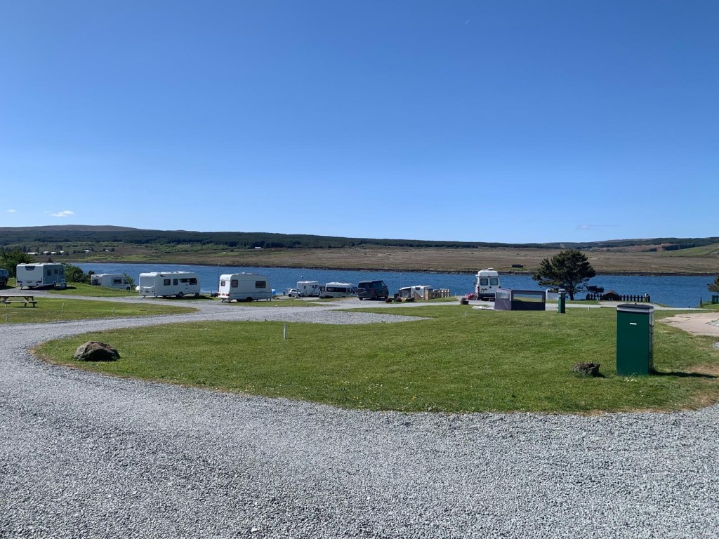
We arrived at the campsite just after 5 pm. We had a walk at the beach for an hour.

Balranald Campsite.

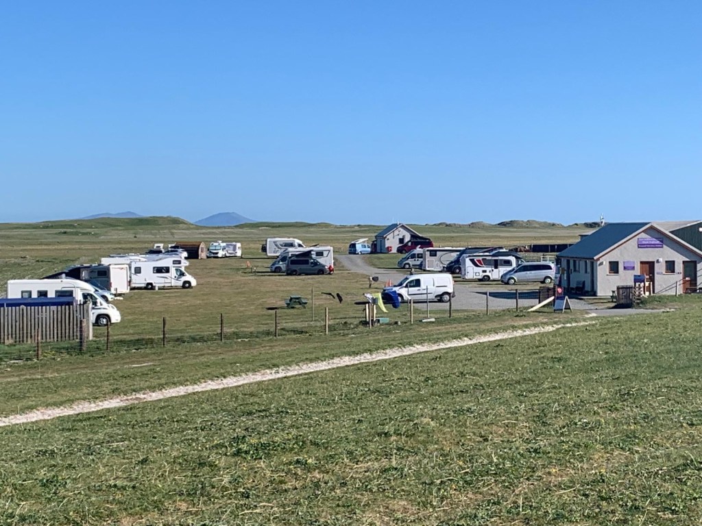
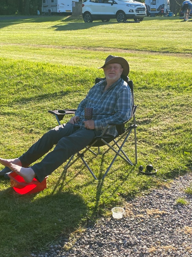
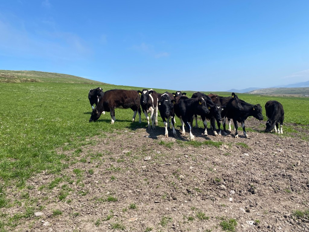
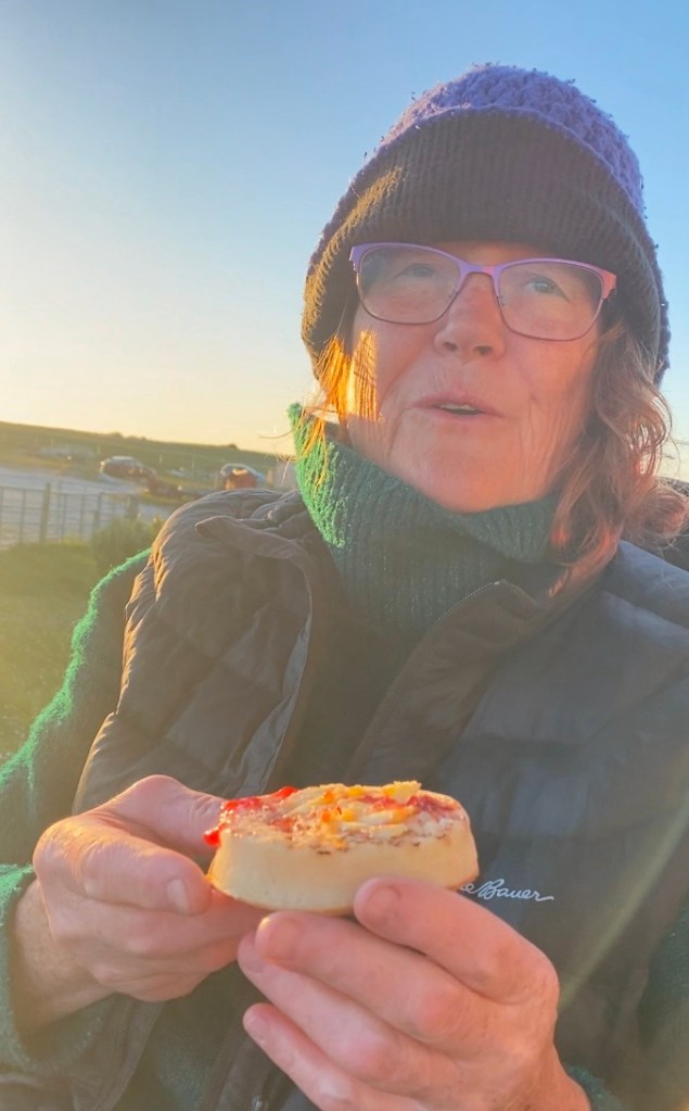
Back at the campsite, we had a wonderful birthday chat with my mom, brother and aunt. Mom assured me a chocolate cake with candles would be had when I got home. Afterwards, Guy and I enjoyed a picnic style dinner next to the van, looking out to a field of cows. What could be better. 🐄🐄 Guy and I sang “Happy Birthday” as I blew out the pretend candles on the crumpet and jam that we shared.

My Birthday Crumpet

May 23d

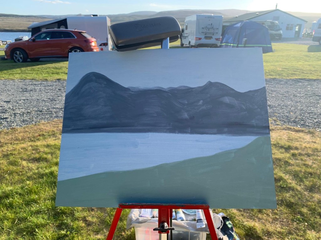
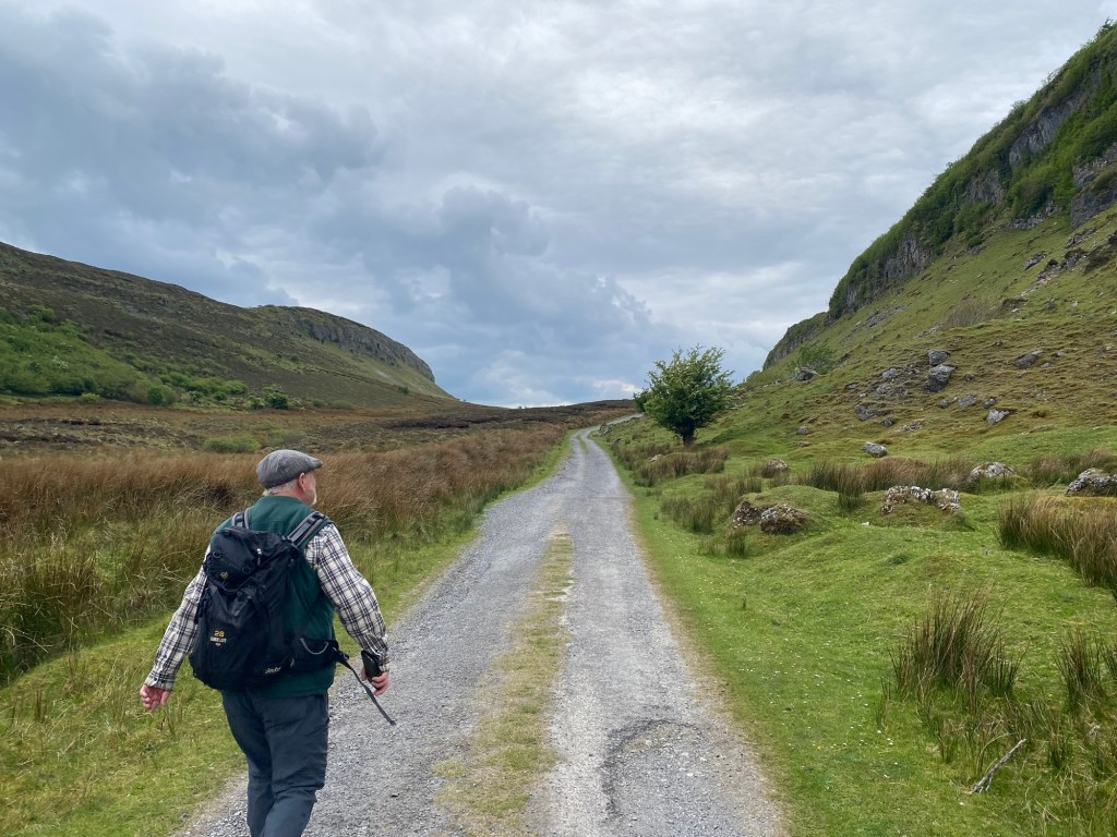
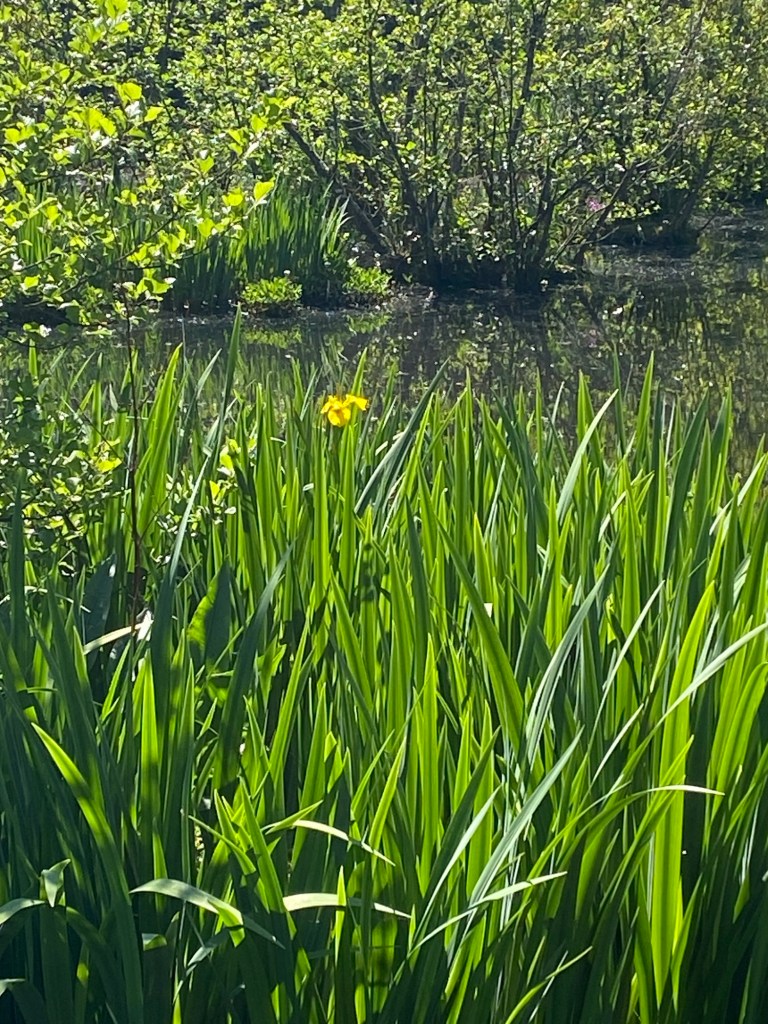
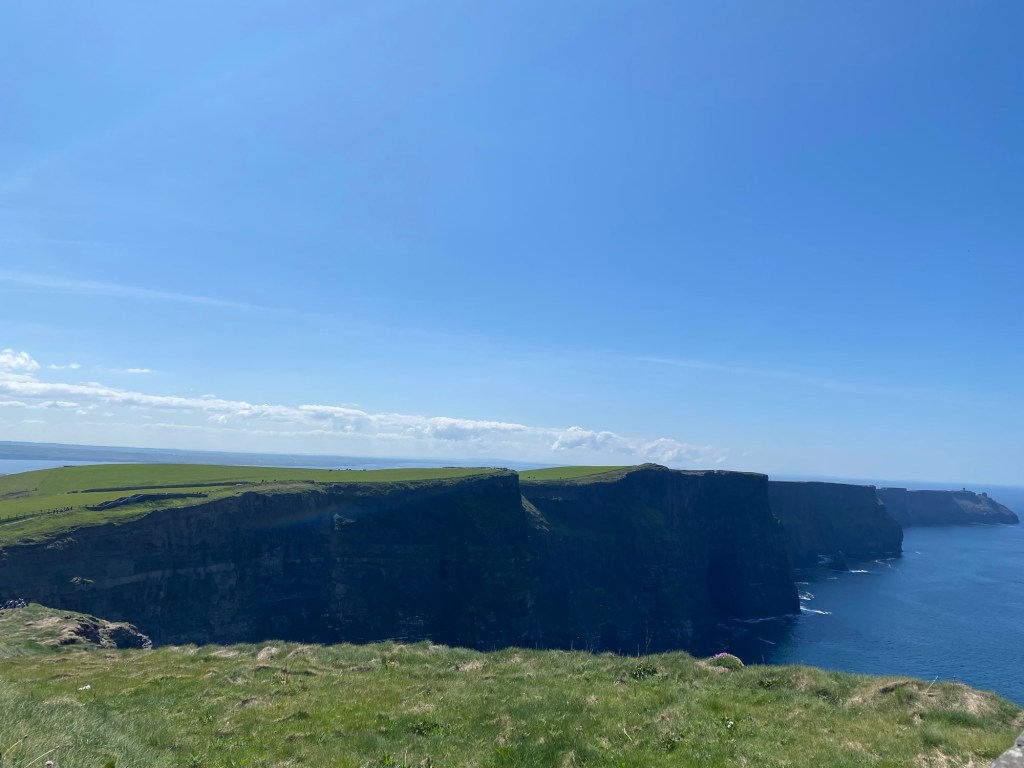
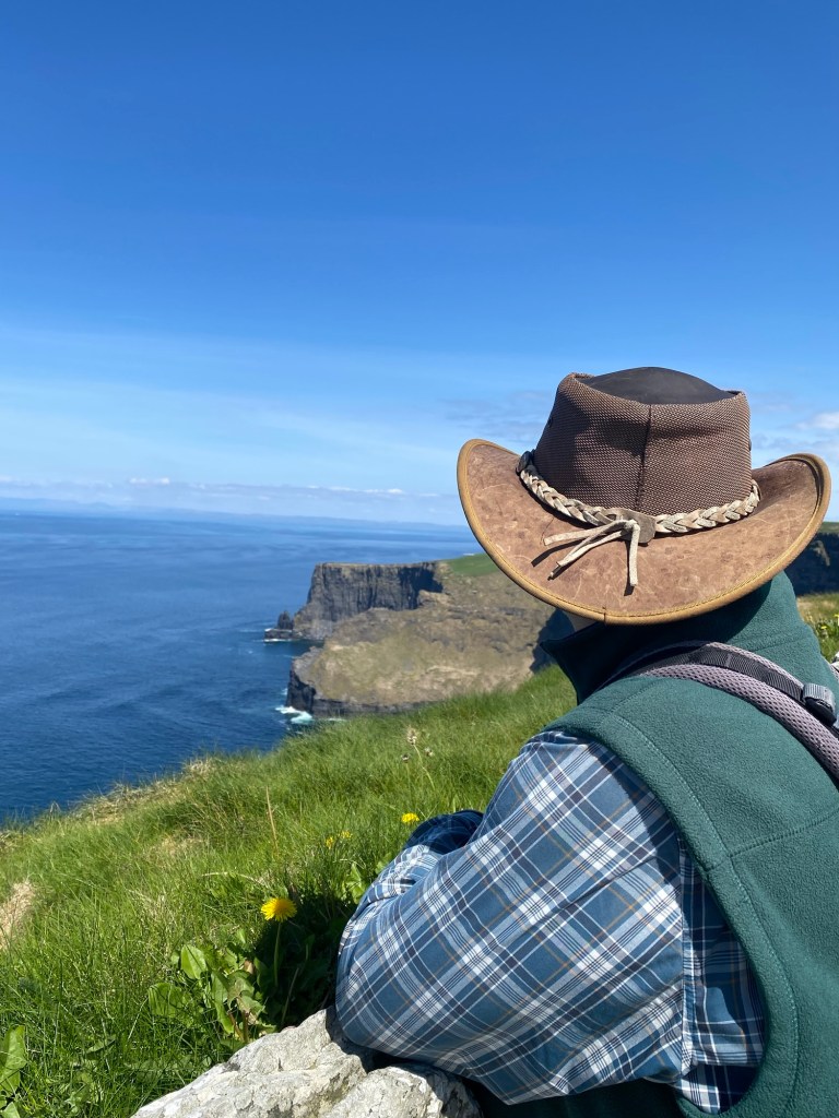
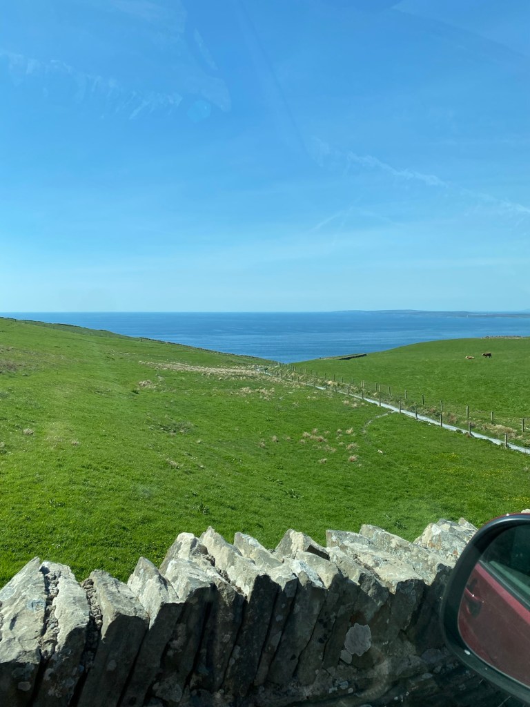
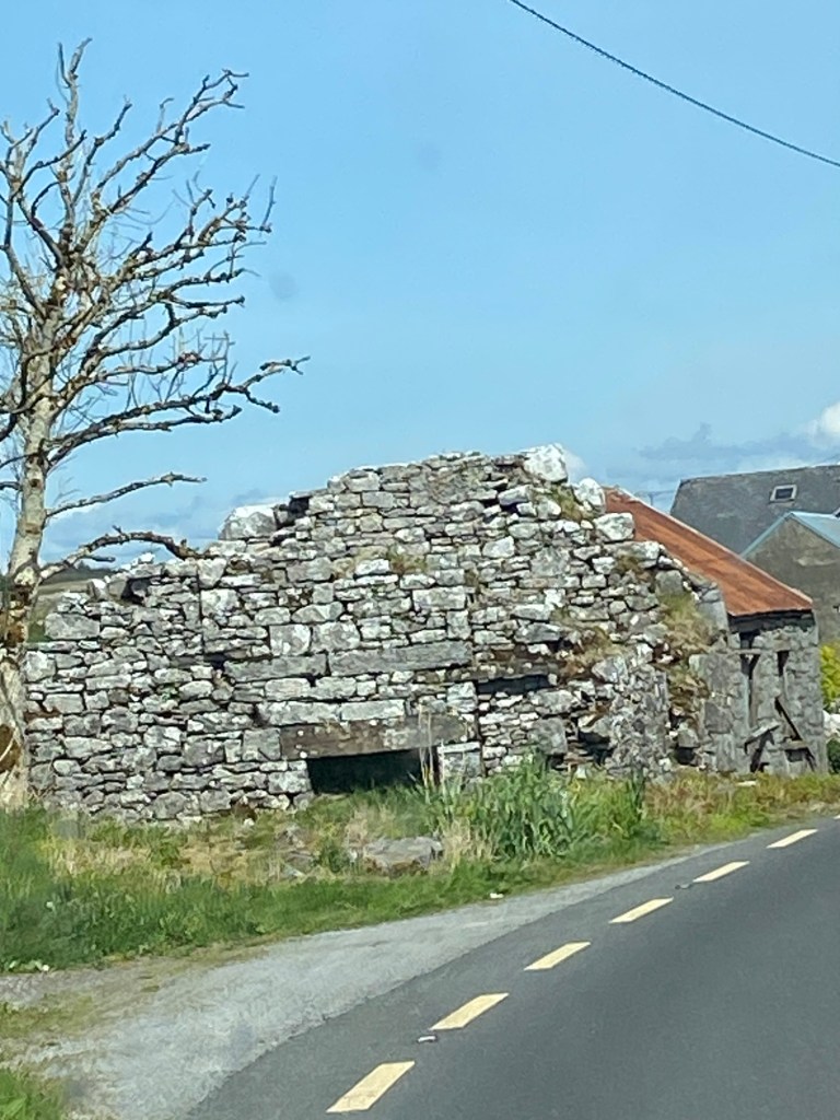
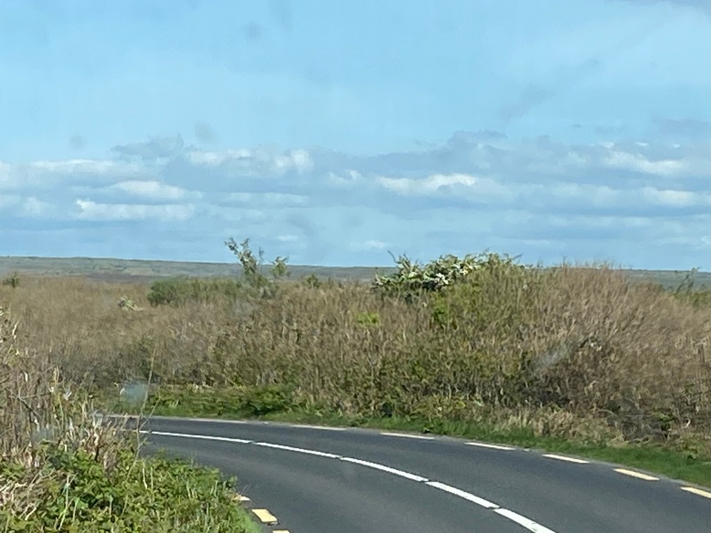
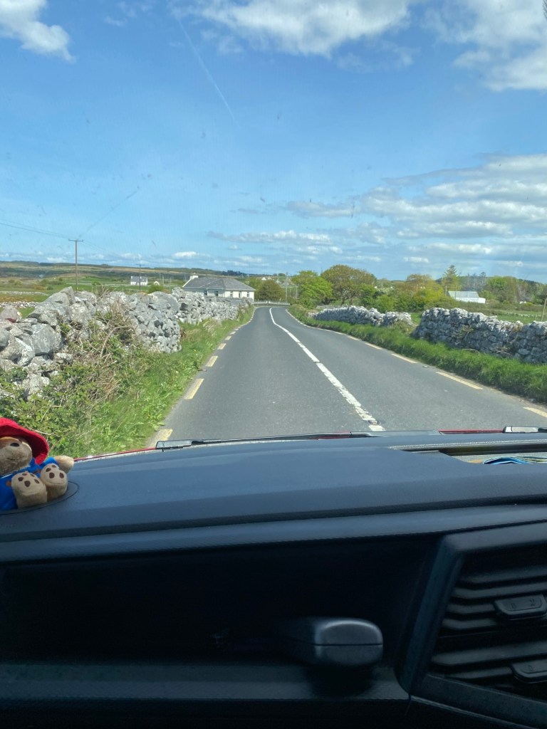
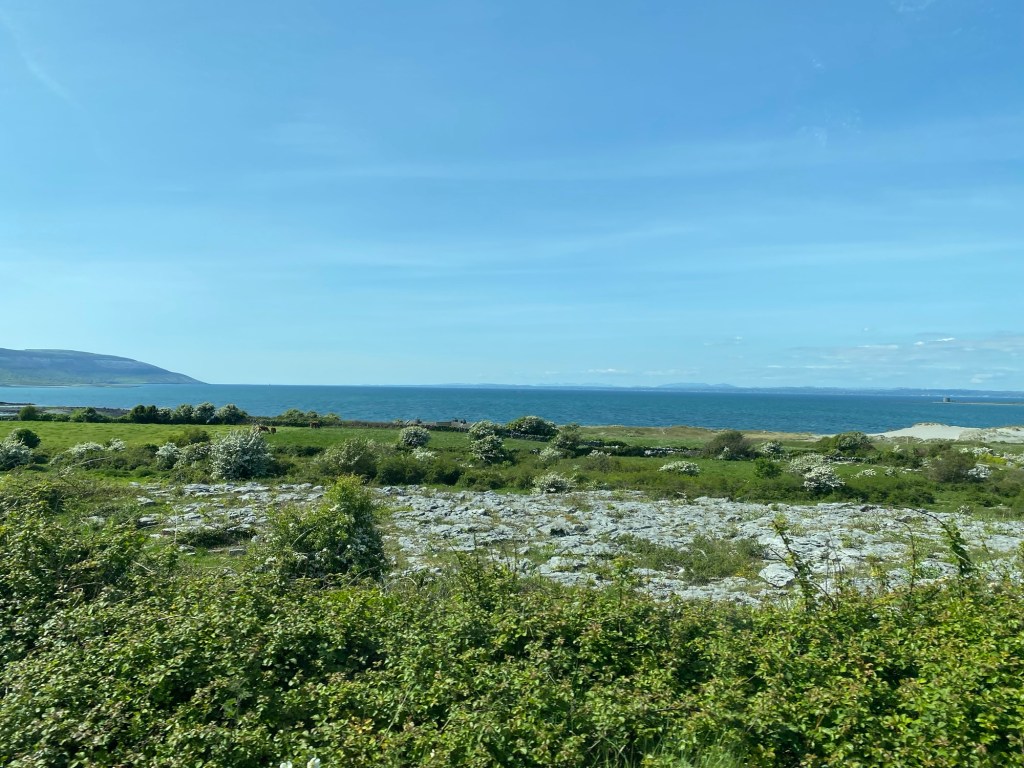
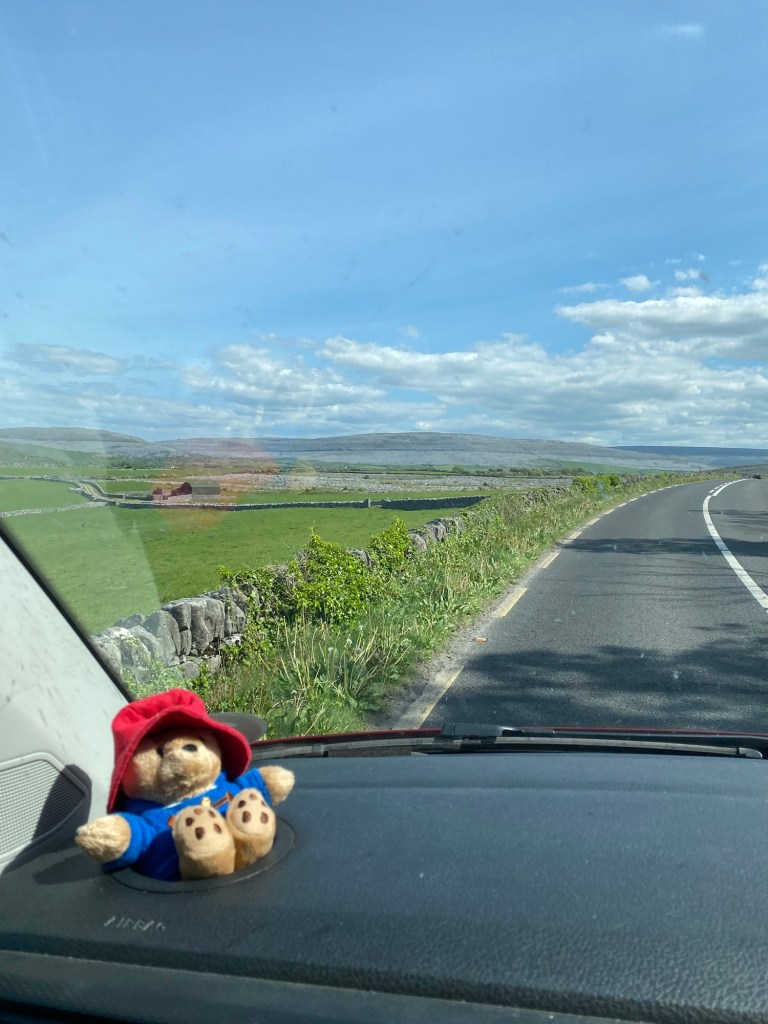
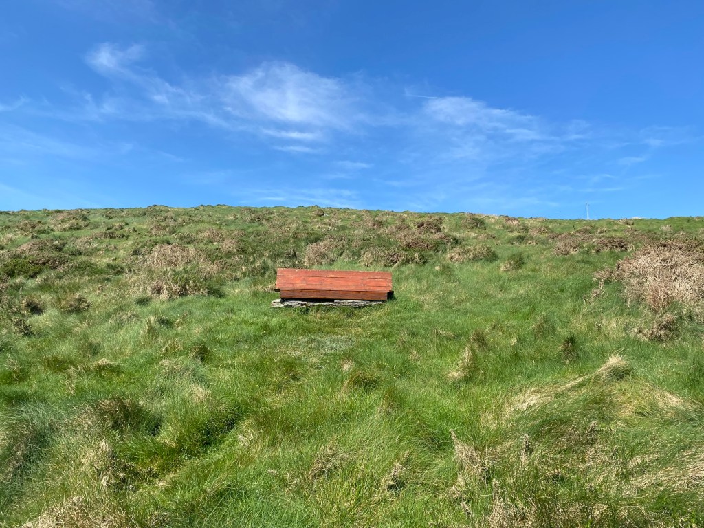
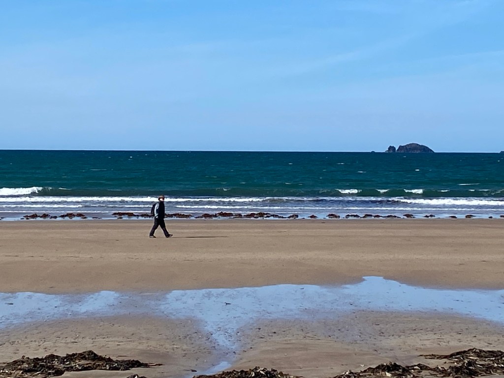
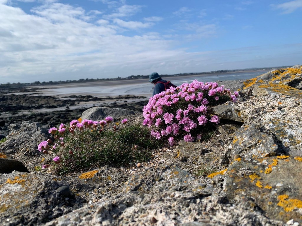
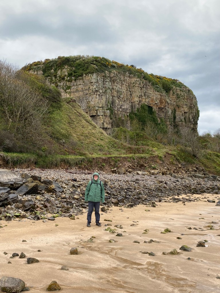
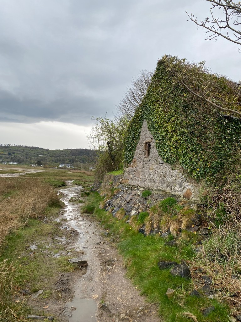
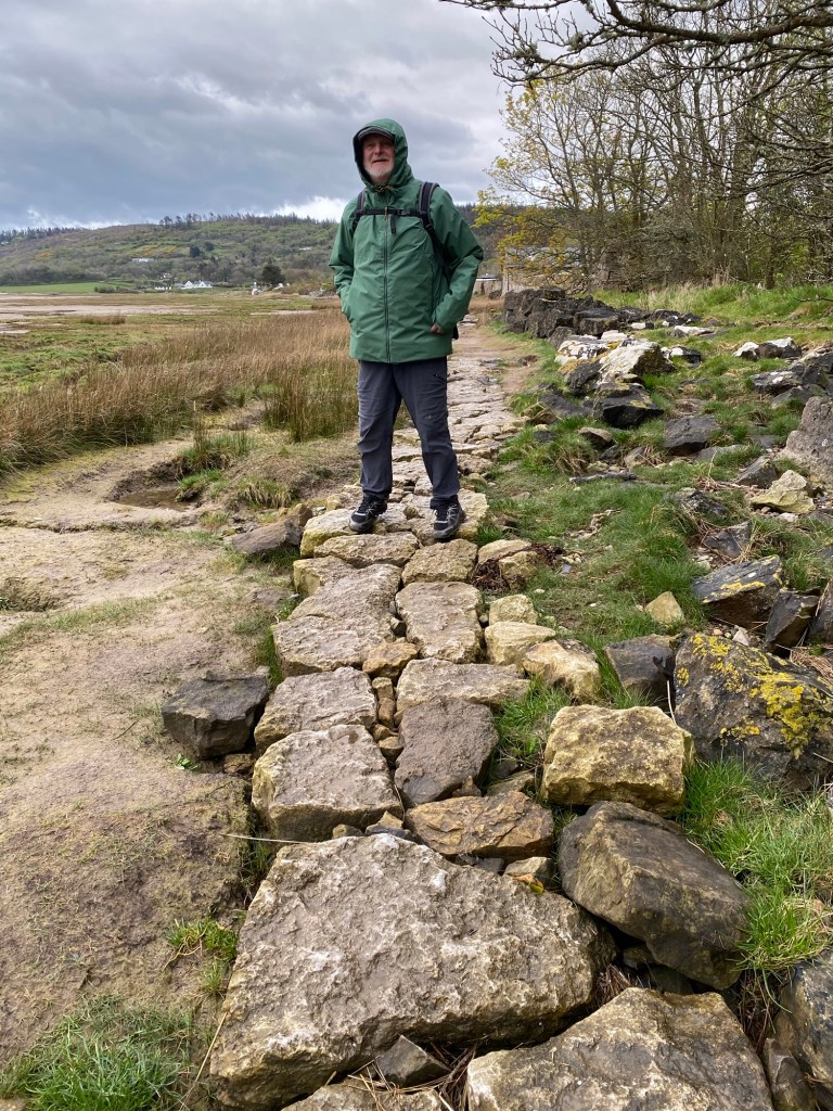
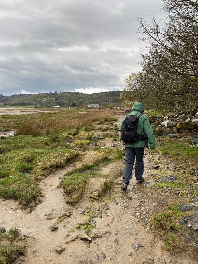
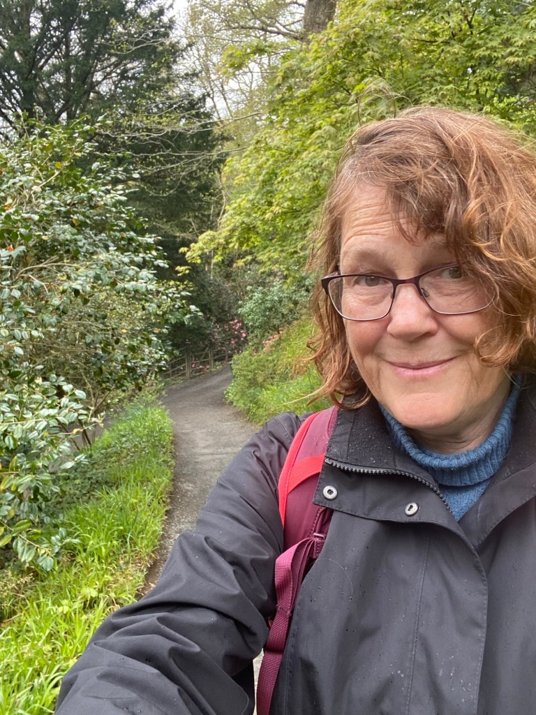
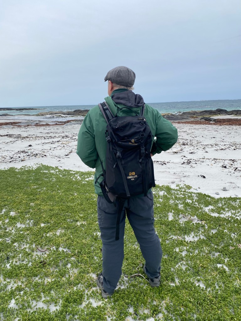
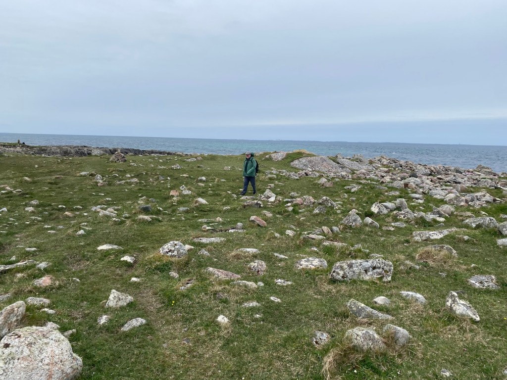
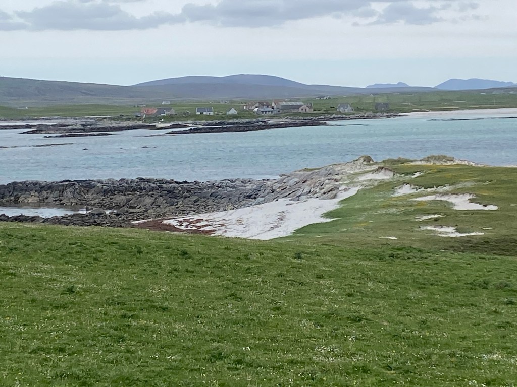
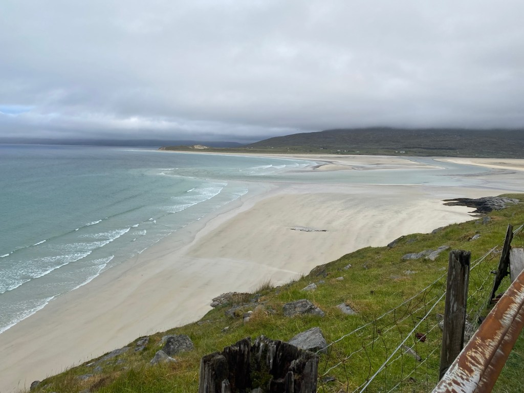
The windy walk in the nature reserve near the campsite was invigorating. This coastline on the North Atlantic is raw nature and is a habitat and nesting area for migratory birds. The landscape above shore is bleak but interesting with rocks scattered throughout the area, maybe debris from the last ice age. This area reminded me of the Burren in Ireland that I wrote about in an earlier blog.

Looking out to the North Atlantic.
Miles of gorgeous beach.
Cairns to show the trail around the headlands.
Sea Thrift
Headlands
Sea Campion
View back to bay where we were camped.
Yellow Iris also known as Yellow Flag.
Guy’s next painting model.
English daisies everywhere.

We headed back to the campsite in the mid afternoon as the foul weather moved in. Enroute, we grabbed a coffee for Guy and cake for each of us from the pop up cafe at our campsite. Once back at the camper, we put the heat on and the kettle on for my cup of tea.

It was a very stormy night with high winds and rain. I went to bed anxious about a rough crossing to Harris in the morning. We had to take the pop up part of our camper van down and the outside privacy blanket that lays over the front windshield off, so they weren’t damaged from the wind.

May 24th

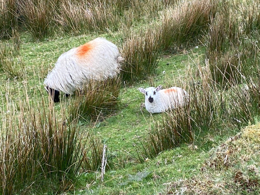
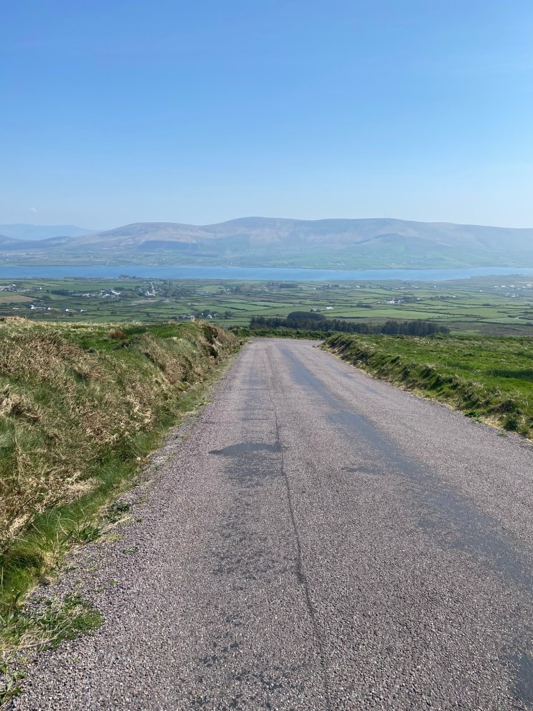
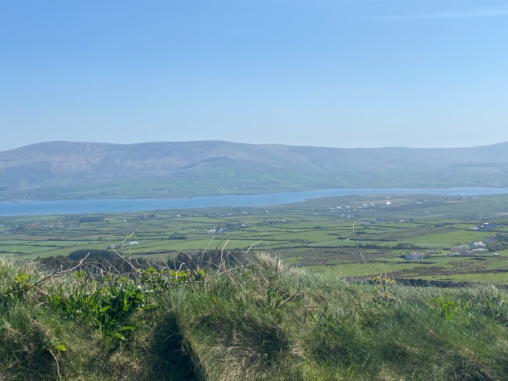
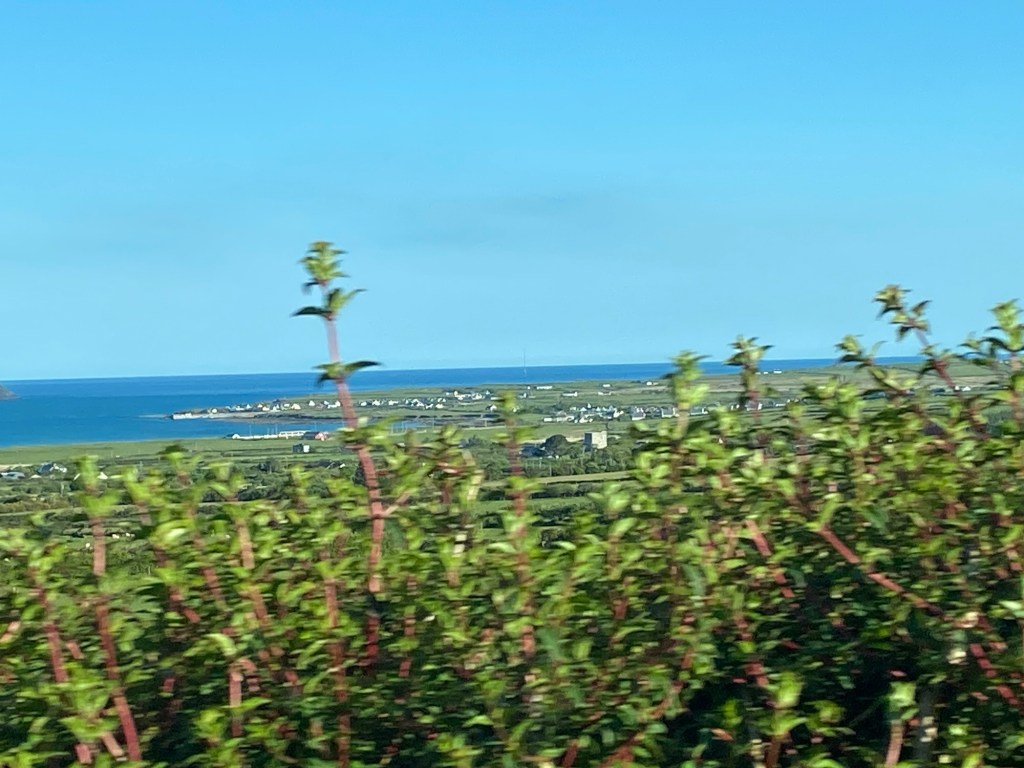
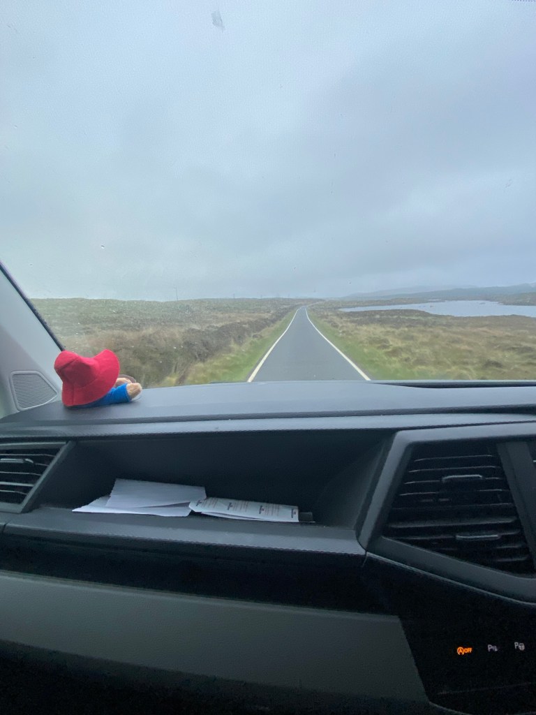
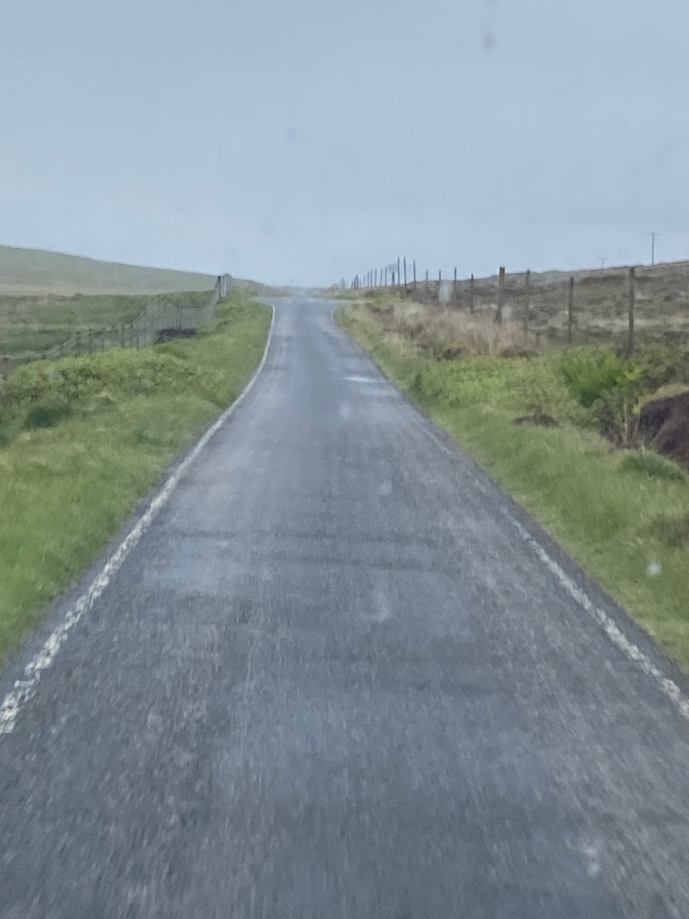
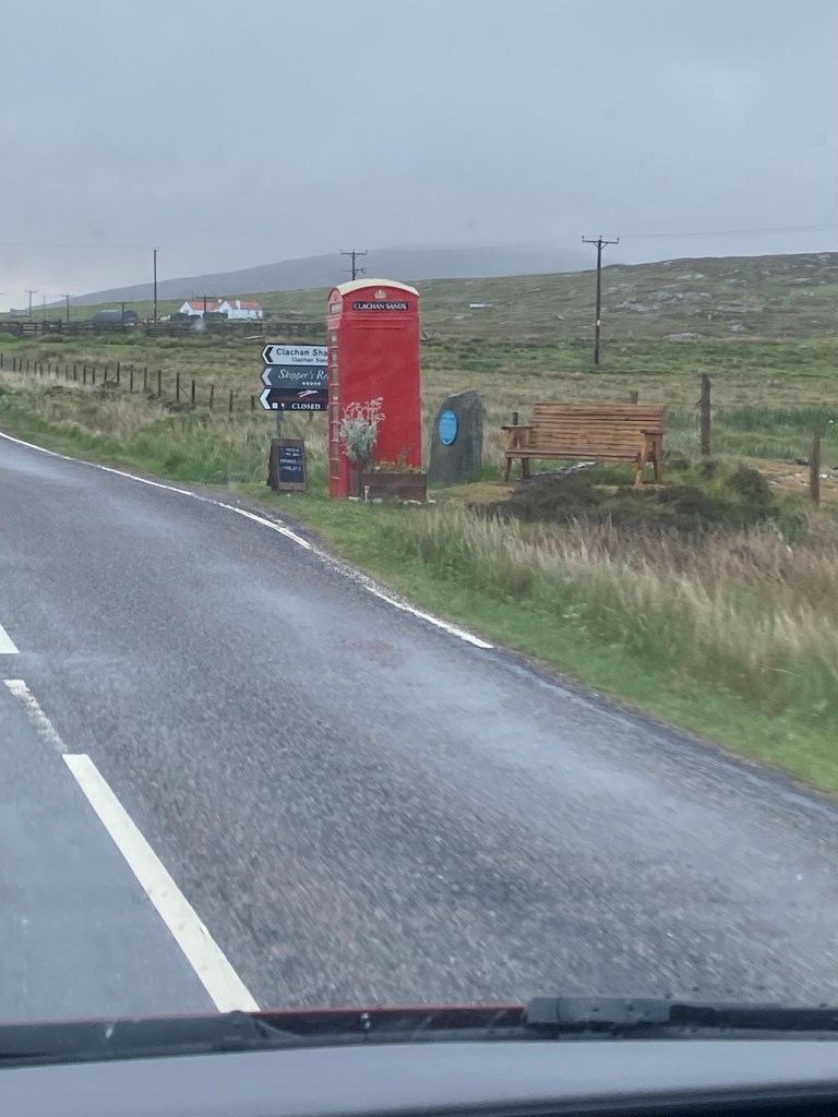
In the morning, the winds had died down considerably. We were up at 4:45 a.m. and enroute to Berneray ferry terminal by 5:20 am. Berneray is a small island north of North Uist linked by a causeway. The early morning drive on that misty, breezy, sheep filled, single track road is one I won’t soon forget.

5:20 am on the A865 to Berneray. Traffic light except for sheep.
Light traffic this morning in both directions.
Old red phone booth. Cheerful to see on this dreary morning.
Causeway linking North Uist to Berneray.

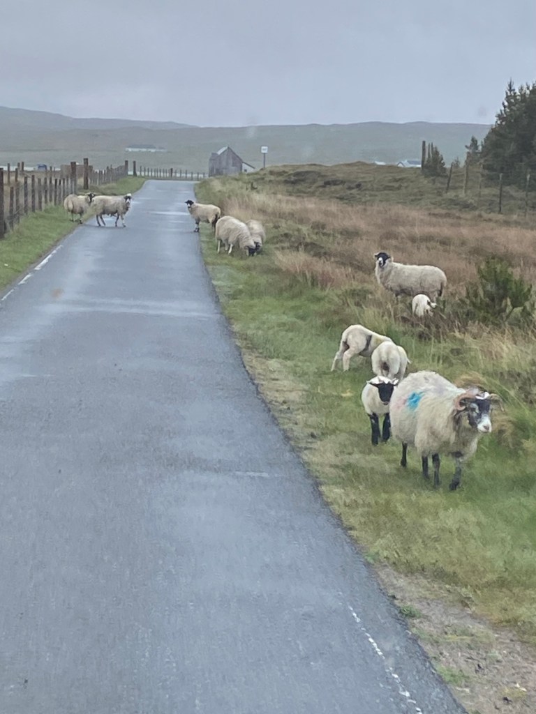
Guy read me some of his journal entry of this morning and I thought it would be fun to share.

“While it is fresh on my mind, we’ve literally just pulled into the ferry terminal to Harris. What a jaw dropping drive. It was from our campsite at Balranad on the northwestern salient on North Uist. We left at 5:23 am taking some 40 minutes to reach Caledonian MacBrayne terminal in the middle of nowhere, crossing an artificial stone causeway to Berneray Island. The drive through misty landscapes with sleepy sheep getting off the road while their panicked lambs rushed ahead of us up the single lane roads. We noticed many rented out accommodation along the way. Could tell by the range rovers parked outside. There was a developer that was blotting the landscape building out of character homes using vertical board and batton. It looked out of place compared to the stone and whitewashed exteriors of the old houses. In one area, tons of rabbits frolicked around including on black one. Saw a snow owl hunting low over the areas much further on. The heather’s were in their “dark stage”. Up and down; these refurbished single lane roads were like a continuous beach edge with gleaming white lines. Joy took some video and pics. I think one of the best early drives I’ve ever done. We’re second in line, writing this at 6:30 am with the boat leaving at 7:15am”

Arriving at Leverburgh on Harris.
Paddington at the front of the boat.

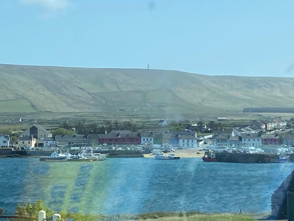
After arriving at the terminal at Leverburgh on Harris, we got coffees and a bacon and egg bap for Guy at the “Botty Bus” takeaway at the ferry. Good positioning for the business as there is no catering on the ferry.

Then we made our way to Tarbert, the main town on North Harris.

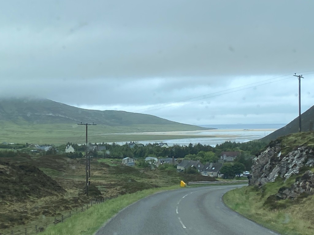
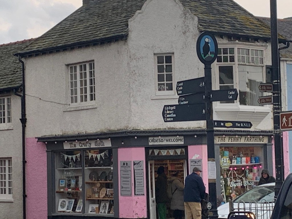
Tarbert is a cute little town with a few shops and services. It’s also has a ferry terminal with a boat leaving many times daily back to Skye.

The goal at Tarbert was to visit the Harris Tweed Shop.

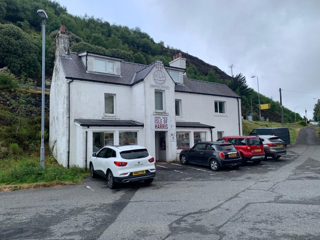
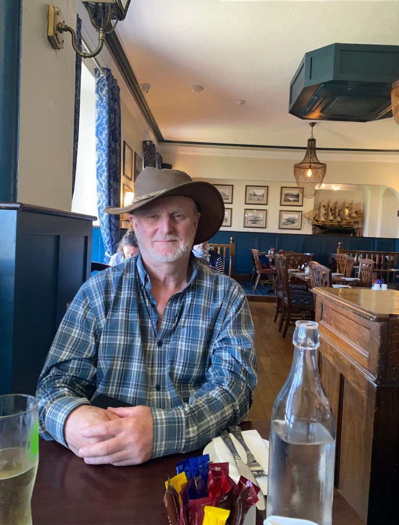
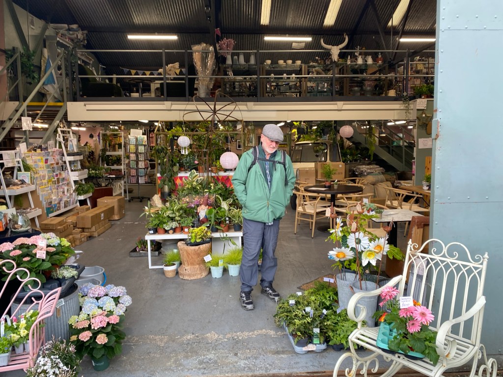
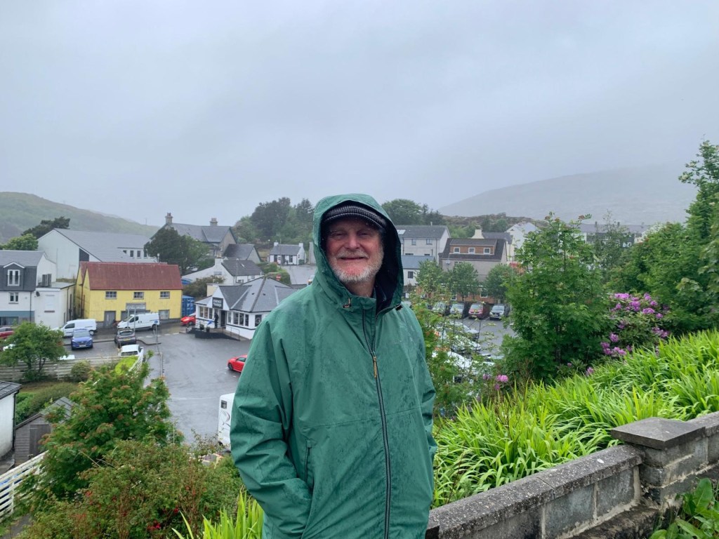
Well Guy did it. He bought himself a lovely tweed jacket. It is a kind of lightish beige with a hint of green with subtle blue and brown stripes. He looks very smart in it and I think it will get a lot of use over the years. (He was painting at the time of this picture and I wasn’t going to ask him to put the jacket on for a picture in case he got paint on it).

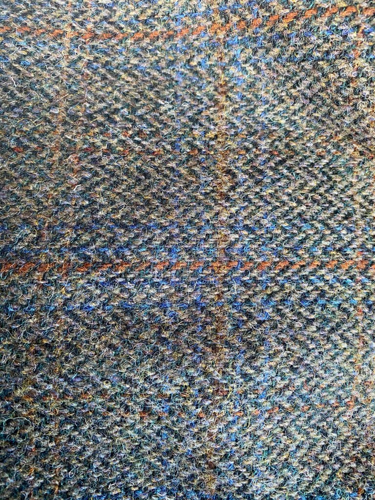
We also bought a really nice orange and green plaid blanket for our living room. I know that it will be well used next winter.

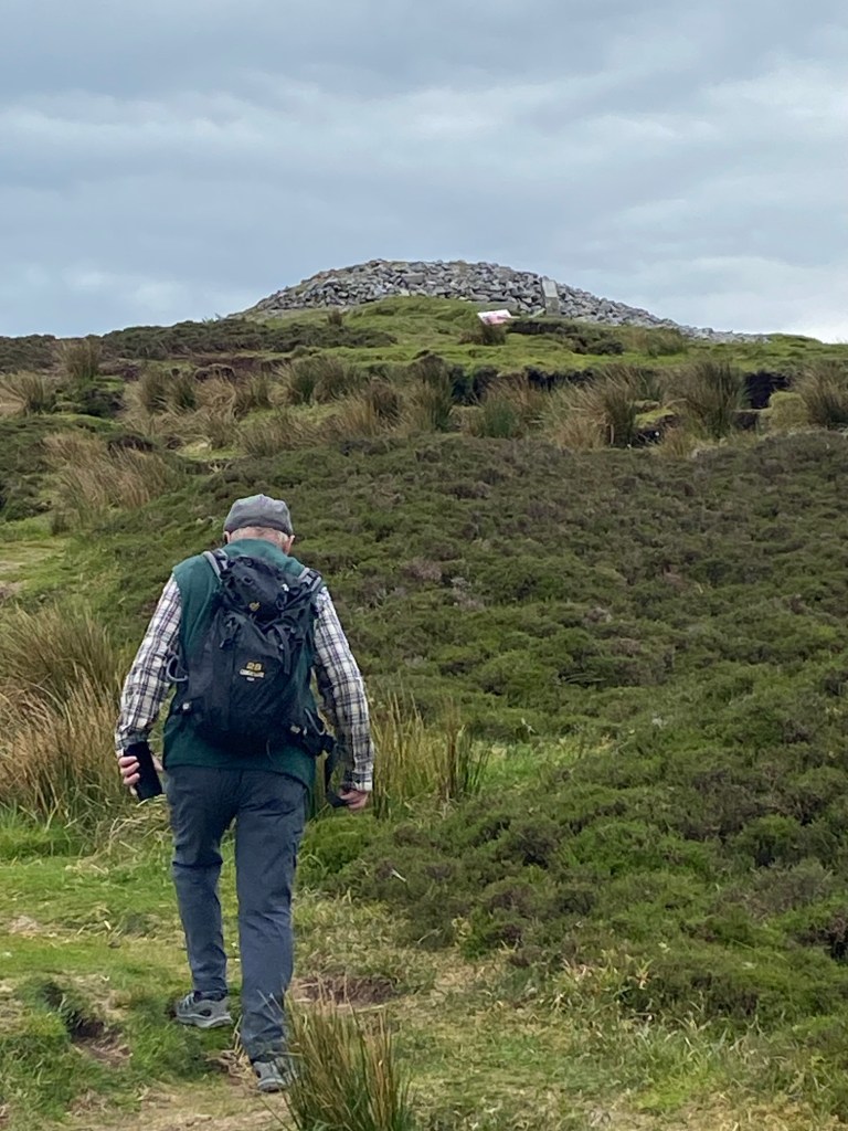
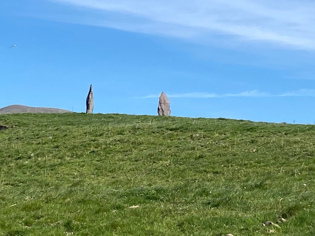
Afterwards, we had lunch in the van and then headed back south to book into our campsite. Then we left the van and headed out to wander the beach and hills nearby. We went to see MacLeod’s Stone or Clach Mhic Leoid in Gaelic, a Neolithic standing stone believed to be part of rituals.

Elder couple from our campsite at the standing stone unawares of the photo.
Crazy hair. The wind is driving me nuts!!!
Beautiful sandy beaches all around.
Guy looking in the direction of our campsite. It’s up on the hill.

After dinner, we battened down the hatches of the van including bringing the pop up part back down. Apparently we were in for a stormy night. The forecast wasn’t wrong.

To the Bonnie Land.

May 15th

We left for Scotland on the 11:30 am ferry from Belfast to Cairnryan. It was a smooth sunny crossing. Seemed liked no sooner had we got out of the bay and said goodbye to Ireland that we saw the shores of Scotland.

Bye bye Ireland.
The last sliver of Ireland.
First signs of Scotland.
Coming into Cairnryan, Scotland
Coastal view of the Firth of Clyde
Aisla Craig Island. Uninhabited and a bird colony with gannets and puffins.
Foot soak at the campsite.
Sunset at campsite.

May 16th

Mid morning, we went to Culzean Castle, just a 15 minute walk from our campsite. We walked the grounds and toured the inside by of the castle.

Culzean Castle
Isle of Arran in the background.

Then we walked the trails through the estate and had some beach time. The amount of beach glass we collected in a half hour is unheard of at home. There was heaps of glass. I hope I find room in the suitcase later😆.

Searching for beach glass.
Toes in the Firth of Clyde
Sunset looking out to the Isle of Arran.

May 17th

We set off from our campsite at Culzean to visit Guy’s cousin Nick and his partner Ruth in Glasgow. It was a relatively easy one hour drive.

Oldest and youngest cousin together again.

It was wonderful to see them and learn about their lives in Glasgow. Ruth made a fantastic lunch for us and we ate under the umbrella in their backyard. It was another very hot day, probably 24C. Unusual weather, our friends and acquaintances in the UK and Ireland keep telling us. Yet the sun shined on for us. 🌞

Later in the afternoon, after it cooled down a bit, we took the bus into the west end of the city for a look around.

Sights around Glasgow
Walking along the river path near the university.
University of Glasgow
Busy Glasgow city scene.
Greenhouse at the botanical gardens.

After a rip around the west end for a few hours, we headed back home. We had a nice meal and an evening of visiting ,and then, a good rest in a comfy bed.

May 18th

In the morning, Nick and Ruth took us to Loch Lomond. We took the low road😁.

We had a walk, saw some gorgeous views, had lunch and Guy even got in a swim. It was a great day.

Loch Lomond
Picture with Tom Weir statue. He was a well loved Scottish writer, broadcaster and mountaineer.
Nick and Ruth
Guy going for a swim in Loch Lomond.
And he’s in.
Ruth and Joy

May 19th

We got up in the morning, had breaky and headed off to Stirling Castle, about an hour north of Glasgow. We were a wee bit tired of castles but this one was a have to see. It’s very intact and has an interesting history with many battles fought at the castle and the lands below. We took a guided tour for an hour. Our guide with his thick Scottish accent needed subtitles but we got the gist of some of Stirling Castle’s history.

Stirling Castle.
View from Stirling Castle.

Later in the day, we met Nick in Glencoe. The scenery without a doubt was some of the best on the trip yet, stark and vivid, green, un-treed hills and mountains and ominous looking clouds as a backdrop, an awesome feast for the eyes around every corner.

We parked in the heart of the mountains and went on a walk over to the other side and up the trail a ways to get a better view.

After the walk, Nick joined us at the campsite for a bite to eat before he made the long drive back to Glasgow. Our meal started out el fresco until the midges and light rain chased us into the van.

May 20th

We left our van at the campsite and took a wander that day. We started at the visitors centre near our campsite and looked at the excellent exhibition there that touched upon the history of the area of Glencoe and the people and hiking clubs that helped build the interest in these mountains including work in mountain rescue and avalanche research.

Glencoe

Then we wandered into Glencoe Village and had a coffee and looked around the town.

Around Glencoe town
Loch Leven at Glencoe Village
Around Glencoe village

We walked a trail near the town that brought us to a lovely river where we whiled away some time and Guy cooled off his feet. It was a heavenly spot.

Then we wandered back on the trail to our campsite.

May 21st

We got up and started the drive to Skye, about 3 hours long. We took the A82 road to Invergarry then from there the A87 to Skye. It was 2 lane roads the whole way but good condition. We passed a lot of lakes and again, stunning scenery at every turn.

After about two hours of driving, we stopped at Eilean Donan Castle. It had a huge parking area that was jammed but we managed to find a spot. We took some photos outside of the castle and saved about 23 pounds ($43 CDN) by not going in, used the facilities and had a coffee.

We went on to Skye over the Skye Bridge. It crosses Loch Alsh and was opened October 16, 1995. Guy took the ferry over to visit his Aunt Adia in 1988.

Main village on Skye where we picked up our groceries.
Guy started a painting at the campsite late afternoon.
Sundown.

Famine and Rocks

May 10th

We left our campsite in Clifden at Connemara after breakfast. We were treated to incredible scenery on our way out. It was actually the same scenery we came in on. It always looks different in the opposite direction😁. We realized later we should have gone in another direction through Westport and then out to Strokestown.

We headed east for 2.5 hours. We were going to The National Famine Museum in Strokestown in County Roscommon. We had missed the Famine Museum in Dublin and felt it important to have some education about this terrible time in Irish History.

The drive to Strokestown was on many a country road and the scenery was the best of Ireland

We finally got to the National Famine Museum and had lunch in the van before seeing the Exhibition.

Between 1845 and 1852, Ireland’s potato crop got a blight and it wiped out a major food source for a lot of the population. It brought on more poverty and famine to a population that was already struggling.

At Strokestown where we were visiting that day, the Mahon family were the landowners for 300 years. In 1847 during the blight, many were offered passage to North America, including Canada. The catch was, they had to walk the 165 km to Dublin to get the ship to Liverpool to meet other ships to take them across the Atlantic. 1490 people walked the route from Strokestown estate. Many died enroute during different legs of the journey. All immigrants to Canada went through Gross Isle in the St Lawrence to be processed. There is a graveyard on Gross Isle that has 5424 Irish people buried there. Many more died at sea.(https://en.m.wikipedia.org/wiki/Strokestown and https://strokestownpark.ie/).

There is a walking trail now from Strokestown to Dublin that commemorates the route the people had to walk to escape the famine.

After the informative and moving time at the museum, we walked around the gardens and forest walk. It was a warm afternoon and very pleasant.

We capped the time there off with afternoon coffee then made our way to our campsite on Lough (lake) Arrow in Riverstown in County Sligo, one hour away.

May 11th

In the morning, we ventured up into hills above Lough Arrow, about a half hour drive from the campsite, to see the Carrowkeel Passage Tombs.

These cairns are from approximately 3500 BC, 5500 years old and built by Broze Age peoples to bury their dead. They are at hilltop locations across the landscape which we could see in the distance. We visited 4 of them.

“Carrowkeel, the most beautiful and mysterious collection of the Irish megalithic monuments, is part of an extensive landscape settled by early neolithic cattle-farmers from Brittany”. (http://www.carrowkeel.com/sites/carrowkeel/index.html)

An added bonus of this walk was the almost 360 degree views.

Afterwards we walked for an hour on the Heritage trail nearby and the geography along the way was awesome.

May 12th

We woke up to a cloudy day on Lough Arrow. We had a long drive (in our present UK and Ireland standards) of 4 hours to the Giant’s Causeway in Northern Ireland. Our time on the Wild Atlantic Way, which we had basically been following since Killarney in the southwest of Ireland, was soon coming to a close.

We got on the coastal route through Sligo and up to Donegal then ultimately cut in east toward Northern Ireland. Somewhere around Derry/Londonderry (It’s the same place and you call it either depending on your sentiments toward the UK) we went from Republic of Ireland into Northern Ireland.

And then we joined the hordes down at The Giant’s Causeway. I took pictures at angles to try and hide the hundreds of people but they were there. 😃

Then off to our campsite,south of Belfast, we headed with little offshoot roads from the main ones that google girl decided to show us that afternoon.

We skirted by Belfast to our campsite, Delamont Camping and Caravanning Park, near Killyleagh, a fourty minute drive from Belfast. Our plan was to go back to Belfast by bus the next morning for the day. We realized though that the commute by bus back to the city would be about 3 hours return. Our campsite was in the country in a beautiful area with lots to see and do so we made the call to skip Belfast. Maybe next time.

May 13th

In the morning we walked a beautiful loop trail from our campsite.

After the walk, we had a quick lunch at the campsite and then headed out to Rowallene Gardens, a National Trust site. We got in for free because we are members of The National Trust of Canada. Our membership is recognized in the UK. Thanks again to Caroline (my sister in law) for urging us to join. We’ve saved a good amount being members. And it makes us feel better about our coffees out.

Rowallene Gardens was layed out and built in the 1860’s by Reverend John Moore. In 1955, it was taken over by the National Trust.

The Gardens have a big collection of rhododendrons and azaleas and there were many in late bloom when we visited as well as other amazing specimens.

Fern Island.
Azalea
Redvein Ekianthus. ( Looked it up. Not that proficient in Latin😆)
Towering Rhodendrons.
Pink Rhododendron
Camellia
Very pretty vine which I am having trouble identifying.
Ferns on wall. 😁
Chilean Fire Tree (Embothrium).
Chilean Fire Tree up close
Rhododendron Jungle.
Azaleas and candelabra primulas in foreground.
The woodlands. Looks like a painting.
Part of an old wall.

After our time at the gardens, we ventured into Killyleagh for a look around, a grocery shop, a walk in the Harbor and a bite to eat in an old pub called the Dufferin Arms. It’s pink!

Dufferin Arms.
Killyleagh Castle. Privately owned.
Random colourful houses.
Down by the water at Killyleagh.

May 14th

We headed out to the Mourne mountain area south of our campsite. There are many trails in the area and it is a Mecca for serious hikers. We visited Tollymore Forest Park at the base of the Mournes. What a stunning area of Northern Ireland.

When we arrived at the park, there were about 25 people all dressed in black capes huddled in the parking lot getting pictures taken. We were intrigued and wondered if it was a witches and warlock convention. Later I read that The Game of Thrones filmed a lot of scenes in Tollymore and that the people in capes were on a tour.

After walking for a couple of hours, we drove to a little town called Dundrum and had coffee. Afterwards, we headed up to Dundrum Castle and wandered the ruin for an hour or so.

The views from the castle were spectacular.

We went back to our campsite for the last night in Ireland. We were off to Scotland in the morning.

North to Limerick and Beyond

May 6th

We set off from our Campsite at Adare, just south of Limerick, after breakfast around 9’ish.

Our lovely campsite in the country.

We were off to The Cliffs of Moher , a very popular tourist site between Limerick and Galway on the west coast. The site gets over 1.5 million visitors every year. Guy had visited 45 years ago when it was quieter and there was just the cliffs and very little infrastructure. The night before, I quizzed him to see if he really wanted to go again. I’m scared of heights so could have easily passed on it. But he thought we would regret not going so we went as planned.

It was a beautiful drive through the countryside on a very good road that gradually gained altitude up to the cliffs. At the top, there was a massive parking lot packed with cars and campers and tour buses. The place was teeming with people, probably 2,000 there all at once and this was early May.

It’s a large site however and people were spread out across the cliffs on the protected walkways and in the interpretative centre so it didn’t feel overwhelmingly crowded. The views of the cliffs were indeed spectacular, especially in the sunshine.

The Cliffs of Moher stand at their highest 700 ft. The faces of these cliffs are shear down to the water. The day we were there, the ocean was calm so there was no substantial wave action and the accompanying sound of waves hitting the cliffs at their base. Without the chatter of all the tourists there that day, the cliffs would have been quiet apart from the cries of the seabirds.

Walking the cliffs, the hairs stood on the back of my neck when I looked down, but I still looked. Back in the day, Guy said there was no barrier to the main area of the cliffs so one had to be sure footed. It’s very safe for a large part of the area now with four to five foot high great slabs of limestone, edge to edge, as a barrier. Weirdly, I took comfort in all the people around as I negotiated the walkway and my fear of the cliffs.

And the view…….a picture says a thousand words.

After a couple of hours at the cliffs including time in the interpretive centre and a coffee break, we headed along the coastal route (aka The Wild Atlantic Way) to Kinvarra where we would be staying for the night. The road goes through the Burren, a landscape that gives you the feeling you might have landed on Mars. The landscape is carpeted with limestone rock from the hills, peppered with the fluffy white hawthorne trees that you see everywhere in this part of Ireland. The whole scene is framed by ribbons of limestone rocks walls and dotted with old farmhouses where there never seems to be anybody home.

The Burren is world famous for its landscapes and for the wildflowers that grow there both Mediterranean and sub-arctic wildflowers coexist. The Burren is somewhere I would spend more time next time in Ireland. (https://www.nationalparks.ie/burren/)

Just a note. My pictures truly don’t do this landscape justice. It is more beautiful than I could capture flying along in the van.

Once in Kinvarra, we checked into our guesthouse. We were having a break from the van for two mights. After dinner, we had a walk around the harbour. Dunguaire Castle graces the harbour.

Dunguaire Castle in Kinvarra circa 1520.

May 7th

We got up and took the one hour bus into Galway. Apparently it’s tough to find parking there so we left the van at the guesthouse. Galway city is in County Galway. It has a lively downtown area with pubs and restaurants and shops and cafes and public squares. It’s a university town and as the term was wrapping up and exams were almost finished, the town was pulsating with young people energy. It was great to see them all kicking back along the canal in the sunshine enjoying time with friends with cell phones mostly tucked away. I had a tinge of envy, remembering those days, the feeling of completion when school was done and the anticipation of the fun summer that lay ahead.

We started out our visit to Galway with a visit to the museum to learn about the area’s history. Then we just walked around taking it all including a nice lunch, a long walk in the harbour, and a visit to an art shop where Guy bought more green paint in different shades. We are in Ireland after all , “this green and pleasant land”. It was another enjoyable city day.

Causeway to the lighthouse.

May 8th

We made the drive out to Clifden in the region of Connemara, County Galway, in the morning and beelined for a Kylemore Abbey where we spent a few hours wandering the estate and trails and gardens. The setting was absolutely stunning.

Kylemore Abbey is a monastery with an interesting history. Set on 1000 acres, it was built in 1868 as a family home. Over time, the property switched ownership until finally it was bought by the Benedictine Nuns. They fled Ypres Belgium in WW1 and ended up in England until 1920. Since then, the estate has been a monastery and nuns have maintained the house and gardens and provided a girl’s private school up until the early 2000’s when demand was down and they had to close. It is still a monastery but now reaches out more to the general community with spiritual and educational programs and has plans to expand its retreat aspect. (https://en.m.wikipedia.org/wiki/Kylemore_Abbey)

Mausoleum where original owners are interned.

At the end of the day, we got a coffee and were sitting near the entrance of the parking lot and a priest walked by. I said to Guy, “there’s a priest”. He acknowledge that indeed it was a priest. Then I told him the story, again, about the priest I met walking from the train station into Pamplona for the Camino. He helped me with directions and walked with me towards my hostel. Before he left me, he blessed me in the street.

As we were leaving Kylemore Abbey, we saw the priest again and this time we said hello. He greeted us back and asked if we had heard the news. “What news?”, we asked. And he told us the Pope had been chosen and that’s the reason why the church bells had rang earlier.

When I was getting my coffee earlier, the church bells started ringing loud and long. I had asked the server at the coffee stand why the bells had rung and he said to signal it was 5:15 pm. But in actuality, it had meant that a Pope had been chosen, an American Pope, we found out later. I laughed a little wondering how T- man was going to botch any form of relationship with the new Pope.

May 9th

We spent a few hours at Connemara National Park and got on some of the trails there. Another amazing landscape with stupendous (looking for more adjectives so I’m not repeating myself) views. We hiked up to the base of Diamond Hill and Guy continued up on his own. I made my way back down and then along other lower level trails.

Guy’s photo from the top of Diamond Hill, 1450 feet.

Afterwards, we went to a beach nearby and Guy had a nap while I looked out to the bay. Then we did a little shop and headed back to the campsite.

May Days

May 1st

Happy May!!!

We set off on this sunny day to start the Ring of Kerry, a very scenic drive around the Iveragh Peninsula. It’s a must see for many folks travelling to Ireland for a holiday and a cherished spot for Irish people themselves.

We did the route counterclockwise as to avoid having to face tour buses on the winding and steep road and followed them instead. One can drive the Ring of Kerry in 3.5 hours without stopping but we planned to take our time over a few days.

Starting the Ring of Kerry

We stopped in the town of Caherviseen at the start of The Ring of Kerry. We had a look around and wandered down to the water. We sat on a bench and ate apples. We met a fellow there named Dermot who is from the town and he told us about Valencia Island and how we should go there because it had the best views. He said it was a short ferry ride away.

Caherviseen. See the castle across the water.

We heeded Dermot’s advice and walked back to the van and headed to the ferry terminal to get the boat to Valencia Island. It was a 10 minute drive. We just missed the boat so had a 20 minute or so wait.

Looking across to Valencia Island.
On the ferry to Valencia Island.
Royal Valencia Hotel where we had a snack.
Looking out of the window at the Valencia Hotel Pub. There’s our van Paddington.
Where are we going? Looking at the trail map.
You tell me.

Once we had a snack and a drink at the pub, we headed up to Geokaun Mountain to see the views that Dermot from Caherviseen recommended. It was a lovely drive across the island to the entrance of walk. We parked and walked to the top.

View back to the Peninsula
I sang to some cows on the walk up to the top. They were a great audience! They especially liked my version of the Sound of Music.

The views from the top of Geokaun out to the Atlantic.

The two islands in the mist are The Skelligs. The island on the right is Skellig Michael and the one on the left is Little Skellig. Skellig Michael has had a monastery on it since the 6th-8th century.

The 2 Skelligs in the distance.
A bench on the hill to rest.
Looking back to the Iveragh Peninsula.

Later, we got back in the van and left Valencia Island. We drove over the bridge, at the other end of the island from the ferry, back to the Inveragh Pensinsula. We had a one hour drive to Caherdaniel where we were staying for a couple of nights.

Portmagee, a little town on the Inveragh Peninsula as we crossed the bridge.
Drive to Caherdaniel where we stayed.
View from campsite.
Nice night for a boat ride.

May 2nd

We had an easy day. Guy painted and I wrote. Midday, we went for a walk to a nearby beach. Guy had a couple of swims while I read. It’s too cold for me yet. Then we got a pizza from the pizza pop up at the campsite. It was a very restful day.

The sunset that night with the sliver of a new moon.

May 3d

In the morning, we packed up after breakfast to finish the second half of the Ring of Kerry.

Wave Crest was such a pretty campsite.

After an hour drive, we stopped in Kenmare to see the town and the Stone Circles there dating back to the 3000 years ago to the Bronze Age. Apparently this is the largest ring of stones in South West Ireland. (https://www.kenmarestonecircle.com/)

Kenmare Stone Circles

Then we got back in the van and continued on The Ring of Kerry. The landscapes were so interesting.

We stopped at Torc Waterfall and walked a 1.5 hour loop through the trails nearby.

Torc Waterfall.

Then we went on to Ross Castle near Killarney.

Ross Castle

Now finished the infamous Ring of Kerry drive, we headed to the Dingle Peninsula for a couple of nights.

We stayed at Campail Teach an Aragail in Gallarus on the North side of the peninsula. Our site had stunning views.

May 4th

In the morning, we got up and went to the Gallurus Oratory, a 1000 year old chapel just a 10 minute walk from our campsite. It the best preserved and one of the oldest churches in Ireland. And the view from in is just incredible with Smerwick Harbor and the Atlantic out in front and the mountains behind.

Afterwards, we walked to the beach via the local castle , Castle Gallarus (Caislean Ghallrois). It is being renovated so we couldn’t go in. It’s just a little castle, actually a tower house. It was built in the 15th century by the Knight of Kerry. (https://en.m.wikipedia.org/wiki/Gallarus_Castle).

We took a footpath down to the beach and then walked the beaches of Smerwick Harbour in both directions for the rest of the afternoon having a break at a pub and later, a late lunch in the van.

We met a really friendly dog on the way.
Beaches at Smerwick Harbour go on for miles.
Standing stones.

Sunset looking out to the Atlantic from our campsite.

May 5th

We got up early and drove the two hours inland to Limerick.

Bye bye Dingle Peninsula.

There was a festival on in Limerick called Riverfest. We checked it out for a bit then wandered the streets over to King John’s Castle. On the way, we saw some interesting murals on the side of buildings.

The River Shannon in Limerick.
King John’s Castle under renovation.
Guy at the top of the castle tower.

Next stop was St. Mary’s Cathedral, founded in 1168. The cathedral like Limerick had a rocky history including the Cromwell invasion where Limerick was captured. St. Mary’s Cathedral was damaged and abused through that period around 1651. (https://en.m.wikipedia.org/wiki/St_Mary%27s_Cathedral,_Limerick).

The Cathedral was closed on the holiday Monday we were there so we just wandered around the grounds and graveyard and took lots of photos.

Pink madness in the graveyard. Valerian in bloom.
Graveyard with ferris wheel behind. Life and death coexisting.

After seeing the sights in Limerick we drove to Adare, a little village on the outskirts of the city where our campsite was. On the way, we fit in 18 holes of golf at the local pitch and putt golf course. It was so much fun. I got the highest score again!

Our campsite was out in the country and so peaceful. We had a great sleep.

Goodbye sweet ponies

April 27th

We left Tree Grove Campsite and Kilkenny in the morning. I loved the ponies that were in the field across from our campsite. Every time I passed them to wash the dishes or visit the facilities, I said hello. They would often come up for a scritch.

Our destination that morning was The Rock of Cashell in County Tipperary on our way to County Cork.

The Rock of Cashell is a massive limestone outcropping with a number of ecclestical buildings towering above the village of Cashell. It is quite an awe inspiring site to see when you first enter the area.

The Rock of Cashell has a wealth of history. From the Heritage Ireland website it says The Rock of Cashell is “iconic in its historic significance” and “possesses the most impressive cluster of medieval buildings in Ireland. Among the monuments to be found there is a round tower, a high cross, a Romanesque chapel, a Gothic cathedral, an abbey, the Hall of the Vicars Choral and a fifteenth-century Tower House.” (https://heritageireland.ie/places-to-visit/the-rock-of-cashel/). Apparently St. Patrick came here in the 5th century from Britain to convert the King of Munster to Christianity. Munster is one of four provinces Ireland was divided into in early times.

Tall cross.

We went on an excellent one hour tour of the site, including Cormac’s Chapel below with 12th century Romanesque frescoes. Apparently they are the only ones left in Ireland.

Cormac’s Chapel named after Cormac MacCarthy, King of Munster. Built in the early 12th century.
Some frescoes exposed. Interesting small sculptures too.
Frescoes

Except for two elderly ladies who have rights to be buried at The Rock of Cashell through a family registry, the graveyard will soon be closed for any further burials.

Lastly on the Rock of Cashell, on September 15th, 1647, Cromwell’s army scaled the walls of the Cathedral and massacred 1000 villagers, men, women and children, who were hiding there. The goal was to obliterate any Roman Catholic strongholds in Munster. Apparently some ghosts have been seen in the buildings at The Rock of Cashell that could be of villagers that died that awful day. (https://heritageireland.ie/2023/10/the-rock-of-cashel-walking-amongst-the-dead/)

Walking the grounds, we saw another ruin in the distance and decided to go see it. It was a half hour walk away and well worth it. Hore Abbey is a ruined monastery built in 1272. It is an exquisite rune (if you can use those two words together)and it’s hard to believe that it is open to the public with no fee to get in. We were the only ones there when we visited. It’s a “have to see” if you are already there for The Rock of Cashell.

Looking back to The Rock of Cashell.

.

The moody skies created the perfect backdrop for photos of the ruin.

We walked back to our parking spot which had a friendly little cafe nearby called Granny’s Kitchen. We had coffee and Irish Whiskey Cake which is similar to fruitcake but just with raisins. Wonderful.

Our drive to Blarney near Cork was straightforward until google girl tricked us again and we ended up on an interesting tour of the hills and back lanes through the countryside. I’m really starting to dislike her.

We decompressed in the late afternoon at the campsite, playing 18 holes on the pitch and putt. It was so much fun. Oh oh. I think I’m starting to really like golf……

April 28th

We spent the better part of the day at Blarney Castle and Gardens. Blarney Castle was built 600 years ago in 1446. Guy walked up to the top of the Castle and kissed the Blarney Stone. The stone was built into the top of the wall of the castle. An old legend says that kissing the Blarney Stone makes one eloquent. This is the second time Guy has kissed the stone so he’ll be doubly eloquent now.

After seeing the castle and kissing the stone, we wandered the gardens.

Manor House at Gardens
Azaleas were stunning.
Carpet of wild garlic. Wondered why I felt like cooking. 😃
New Zealand ferns
Fern forest

Then we walked loop around the Lake. Then it was back to the castle. We took one more photo (below), got an ice cream, and then, did some grocery shopping and headed back to the campsite for the night.

I spy Blarney Castle.

April 29th

We circumnavigated Cork city and went out to Great Island to the town of Cohb. Great Island is connected to the mainland by a bridge or you can take a ferry there if coming in from the east. The town sits on Cork Harbor, the second largest harbor in the world.

We went into the “Titanic Experience” exhibition located just above the White Star Line Dock, the Titanic’s last port of call before crossing the Atlantic on April 11, 1912. 123 people boarded the ship bound for New York at Cohb. In total, there were 1308 passengers and 898 crew on board totalling 2206 people. Of course most know that the Titanic sank after hitting an iceberg on April 15, 1912 in the North Atlantic. 1517 people perished in the sinking.

We learned that 7 lucky folks got off the ship in Cohb as they had only bought tickets at Southampton to go that far.

After time with Titanic, we went for coffee on the beautiful strip down by the water. It was lovely.

Cohb

We made our way to our Campsite in Killarney. The scenery westward was spectacular. Ask anybody. It was beautiful. So beautiful. It really was.😂 Oops, another Trump impersonation. But truthfully, it was incredible scenery. It’s a different green here, like it’s been given a little shot of yellow.

A Rook visited our campsite. Common in these parts.

April 30th

Today we left our campsite and drove to Kate Kearney’s Cottage and the beginning of the Gap of Dunloe. The Gap of Dunloe is a mountain pass in County Kerry and part of Killarney National Park. We walked the narrow road up to the Gap as there is no trail. Very few cars use it as they are deterred from doing so as it’s a one track narrow road with precarious pull offs. An occasional horse and buggy passes by loaded with folks who can’t or don’t want to make the trek to the views. It took us approximately two hours each way. The Gap of Dunloe is a huge tourist spot. Because of the time of year we were visiting it wasn’t that busy. It was a glorious day with the views and the sun and the breeze, the wild flowers and masses of rhodendrons about to bloom, the bird song and the sheep in the fields

Once to the top, we had a picnic and looked toward the valley on the other side of the Gap. Then we turned around and walked back seeing the beauty in the other direction. Glorious. The pictures don’t really do it justice.

Just a bit more on the Gap: “The Gap of Dunloe was formed 25,000 years ago during Ireland’s last ice age as a result of a “glacial breach” where a glacier in the Black Valley, part of the Templenoe Icecap, estimated to be over 500 metres deep, broke through the Head of the Gap and moved northwards carving out a U-shaped valley. (https://en.m.wikipedia.org/wiki/Gap_of_Dunloe).

Looks more like a “V” to me but I am no expert. 😃

After a very pleasant time at The Gap of Dunloe, we made our way in the late afternoon to Muckross Estate and Gardens, another stop recommended in this area. Muckross is another example of a very generous family donating their estate and lands to the public. When we got there, we beelined for a big old oak tree and had a wee nap under it. Then we wandered the gardens and estate for a couple of hours before going back to the campsite for the evening.

The Muckross Estate
The Gardens

Horses getting ready to go home for the night too.

Over to the Emerald Isle

April 23d

We woke up to cloudy skies and a very light breeze. I was happy that the weather had calmed down overnight.

The crossing to Ireland couldn’t have been better. The seas were relatively easy and the ship was beautiful, almost cruise ship grade. Wow, B.C.Ferries, you’ve got competition.

We met a woman on the ferry who does the return trip 2 times a month for the very important task of getting duty free cigarettes and alcohol. Wow. 3/12 hours return times 2 and the wait in between trips. That’s a long day!

Getting on the ferry at Holyhead.
Bye bye Wales. Thanks for a lovely time.
Ireland ahead.
Coming into port. Busy place.

Once off the boat, we had a 40 minute drive to our campsite at Portrane north of Dublin.

Getting off the boat at Dublin. Same vehicle in front as when we got on.

The route off the ferry was an experience, being on the highway with all the transport trucks, zipping in and out of lanes, and off and on the motorway, Guy had to keep his wits about him, especially through the 2.8 km tunnel. But ultimately we arrived on a two lane road through the countryside to our campsite near the ocean.

After we settled in, I went scouting around to see where the beach access was. I met a woman who had a holiday house there. She told me how after she bought the place, she found out that her grandparents had worked on the island off Portrane called Lambay Island. Then she told me about how her grandfather had died by gunshot in Dublin during the 1916 Easter Rising which lasted 6 days during Easter week. Her grandfathers name was James McCormack. There is lots of info about him online. Citizens were fighting for Irish Independence from the British. 485 people were killed that week including citizens, British military and Irish Rebels, 16 leaders of the rebels being executed. (https://en.m.wikipedia.org/wiki/Easter_Rising)

We had a long walk that first afternoon on the beach. The sun had come out and there was a nice breeze to blow out the cobwebs.

Breakwater

Major erosion is happening to the shoreline in this area. It looks as though many houses could be at risk of slipping in the years to come so measures are being taken to protect properties from the tides. I wonder if storm Darragh that hit Ireland and the UK in December 2024 pushed things ahead.

Whimsical beach art by Joy
More breakwater ideas.
These rocks surrounded by water reminded me of a castle and a moat. Think I’ve seen far too many castles!

April 24th

We got up reasonably earlier to get ready for a day in Dublin. We had a 10 minute walk to the bus stop, a 10 minute bus ride to the nearby village Donabate, a 10 minute walk to the train station, then a 30 minute train to Dublin-Connelly station in downtown Dublin. On the way home, it was the reverse route. It was worth it not to have to negotiate the vehicle through Dublin and try and find parking.

Waiting patiently. We just missed a train.

Once in Dublin, we just walked.

Crossing the River Liffey.
Irish Times newspaper headquarters.
Trinity College Square.

Trinity College was founded by Queen Elizabeth the 1st in 1592. It is one of seven ancient universities in Great Britain. “During the following centuries, Trinity contributed to the flourishing of Irish literature during the Georgian and Victorian eras, in addition to areas of the natural sciences, medicine, and law”. Samuel Beckett (Waiting for Godot), Jonathon Swift ( Gulliver’s Travels), and Oscar Wilde (The Importance of Being Earnest) were all educated there. (https://en.m.wikipedia.org/wiki/Trinity_College_Dublin)

St. Anne’s Church at the end of the road.
Priest greeting folks coming into St. Anne’s church.
St. Annes’s Church of Ireland built 1720.
Street Art.
A big Banana and talented kid hip hop dancers.😃
St Stephen’s Green. One of the sites of resistance by citizens during Easter Rising of 1916.
Old Parliament buildings near Dublin Castle.
Dublin Castle.
River Liffey
On the way back to the campsite from the bus stop.

April 25th

Bye Bye Portrane Beach

We set off in the morning to visit The National Stud and Gardens in Kildare, southwest of Dublin. We were going to see the gardens but it ended up that the equestrian aspect of the visit was the most interesting.

Years ago, when Guy was in his 20’s, he and his friend Karen visited a garden in Wales near Kildare that portrayed and symbolized the stages of a man’s life. Guy couldn’t remember the name of the garden but he wanted to see it again. With a little internet research, I found these gardens as part of the Irish National Stud lands.

The Irish National Stud is a thoroughbred breeding centre for racehorses. Although I have mixed feelings about the horse race industry, the experience there was amazing. Firstly, we went into the interpretive centre and learned all about horse racing and the breeding of horses. Then, hypothetically of course, we got a chance to buy a horse, raise it, train it, dress it, dress ourselves (the jockey) and then race our horse(on a mechanical horse). Guy, I and two others raced each other and it was a total blast. Guy got the nag who actually was moving backyards. The video of the race is absolutely gut wrenchingly funny. We can’t watch it without going into hysterics. You had to be there!!

After an hour or more horsing around😂🫏, we headed out to the gardens Guy wanted to see. They were beautiful Japanese Gardens that had overgrown. They were cared for but the zen like Japanese garden quality that Guy remembers from 45 years ago was gone. He was disappointed. Guess things grew while he was away living his life. 🙂

Below is a life size sculpture of a beloved horse, “Invincible Spirit” who had a brief career as a racer and a longer one as a stallion, producing many heirs that went on to do well in racing. Apparently “Invincible Spirit” is living out his later years at Irish National Stud and is being well cared for. (https://en.m.wikipedia.org/wiki/Invincible_Spirit). The Irish sculptor who did this large project is Simon Karman.

Bug Hotel. Very popular in the UK and Ireland.
Two of the horses at Irish Stud.
Trails through the acreage.
Peace

Afterwards, we drove the one hour and a half to Kilkenny to our campsite Tree Grove, just outside the town. The trip turned out to be much longer as I made the mistake of putting our campsite into google maps instead of Kilkenny. Google girl took us on a country tour. It was lovely but……we are learning.

April 26th

A wonderful thing about our campsite was that it was near a canal walk that went to Kilkenney so we left the van and walked into town. On the way in, we had a phone chat with Guy’s sister Diana in Australia and we were still chatting when we arrived at Kilkenny. What a delight to walk into such a sweet town full of life and color.

We planned to begin our visit to Kilkenny by having a look around the 13th century Norman Castle above the canal. To be truthful though, we were all “castled” out so we walked around the outside and through the gardens then Guy had a coffee at the cafe outside the Castle. I had already drank a pot of coffee at the campsite.

Kilkenny Castle
Gardens at Kilkenny Castle.
Walking the Medieval mile.
Black Abbey
Up to St Canice’s Cathedral
Butter Slip Lane built in 1616 and used to have stalls of butter vendors.
Guy in Butter Slip Lane

We spent time in the late afternoon at the St. Mary’s Church and the Medieval Mile Museum where we learned of the history of the town and its interconnection with St. Mary’s church. Through the ages, this church from the 13th century was a place of worship and burial but also of great upheaval, both religious and political. The church is now a museum. It houses artifacts from the last 800 years. It is flanked by the old graveyard and you can see tall crosses in and outside the church and limestone grave slabs sculpted beautifully by master sculptors. 50,000 people have been buried here through the years. Most of the graves have been left although a few have been opened and you can see the remains and learn about the presumed lives of the people as part of the exhibition.

After the museum, we went to find our first Guinness. I chose a pub with a witchy history.

Kyteler’s Pub where a witch was purported to live in the 13th/14th century.
Info on Dame Alice le Kyteler.
1st Guinness
Ha ha.

Later, we wandered back to our campsite along the canal on what was a perfectly beautiful spring evening.

Stacks, Circles, Gardens and Castles

April 20th

We spent a good portion of the sunny Easter Day out at South Stack Lighthouse on the northwest coast of Anglesey. It was built in 1809 to warn ships of treacherous rocks below.

Parking was at a premium due to it being Easter Sunday. We had lunch at picnic tables on the grass looking out to the Irish Sea. Then we walked the many steps down to the Lighthouse. It was spectacular.

Looking out to the Lighthouse.
Opportunistic flowers in the rocks.
A Stena ferry crossing the Irish Sea.
Beautiful walkway down to the lighthouse. Karen looking for birds.

Afterwards, we walked the trails above the Lighthouse, then descended down to the road ending up at the Ty Mawr Ancient Hut Circles. Remnants of 20 huts can be observed. At its heyday, there was likely a village of 50 huts, likely inhabited by Iron Age peoples as far back as 500 B.C. (https://www.anglesey-history.co.uk/places/prehistoric-monuments/ty-mawr-hut-circles/). The site was absolutely fascinating and interesting to imagine living there a couple of thousand years ago.

After an hour or so, we drove down to Trearddur Bay, a seaside village nearby, had a cuppa followed by a walk along the promenade. The day was capped off with dinner out at a restaurant in Red Wharf Bay. A perfect Easter Day with great friends.

April 21st.

In the morning, we visited the fantasy village of Portmeirion. Described as a “folly tourist village”, it was built by Sir Clough Williams-Ellis, in the Baroque Style and took 50 years to complete between 1925 and 1975. What was the motivation to build this architectural masterpiece? His vision for this place was likely inspired by his time in Portofino on the Italian Riviera. (https://en.m.wikipedia.org/wiki/Portmeirion)

Luckily we missed the Easter weekend crowds. The site is a very popular tourist draw. I’m happy we went as it is a photographer’s dream. Again, I’ll let the photos do the talking.

After a great few hours at Portmeirion, we visited Harlech Castle, the 3d castle of the 4 built by Edward the 1st.

Original large rocks for the catapult to defend the castle from inside.
Looking out the the Irish Sea
Owl on site
Susan and Tricia on the castle wall walk.
Wall walk between turrets
On the way to coffee after castle visit.
Tea cozies for postboxes. Who knew??

April 22

We packed up and left our campsite in Red Wharf Bay on Anglesey for the last time this morning. We were relocating to a campsite closer to the ferry at a Holyhead for the next day’s crossing to Dublin.

We visited the last of Edward the 1st’s castles and the most intact one, Caernarfon Castle. Unlike the others, much of the roofs of the castle were still intact preserving the structure below. We ventured up the towers with rooms and hallways on each level to wander. Guy went up to the turrets on his own.

Coming up to the castle in the town.
Endless hallways to wander.

After the castle, we went for nachos at a pub, and then had a nice walk along the promenade back to the van.

Back in Anglesey, we did laundry. Then we had a visit with Karen in Llangefni before heading out to the campsite. We visited Oriel Mons together, an interesting museum about the history of Anglesea.

Wind and rain moved in during the evening and I prayed it would brighten and lighten by morning for the 3 1/2 hour crossing to Ireland.

Beaumaris, Beach, Bodnant and Conwy.

April 18th

Rain Rain Go Away.

Rain here in Wales comes and goes throughout the day just like at home on the west coast of British Columbia. Today, it was on and off rain with no sign of the sun. Everyone was out enjoying themselves just the same. What do they say, “it’s not bad weather, just bad clothing”.

That reminds me of something I’ve noticed. I was told that British people like to talk about the weather. Is that ever true. Here are two random examples:

Washing dishes at the dish pit at a campsite.

“Hello” I’ll say.

“You’re alright?” they’ll answer. And right away, before I can say that I am fine they add “rain should stop midday I think”.

or

On my way to the toilets in the morning, I see a lady on the way in. She gives a big smile.

“Hello” I say.

“Too bad about the weather. Will get better by Tuesday”, she responds.

It’s mostly the older people that give the weather reports. I guess they have more time to think about it and it’s a very easy and friendly way of talking to someone.

Today, we spent a few hours in Beaumaris, a town on the Menai Strait that separates Anglesey from the mainland of Wales. We visited Beaumaris Castle, the first of four castles we will be seeing in this area.

Beaumaris is the 4th of the castles commissioned by Edward the 1st. This castle was never fully realized and is referred to as “the greatest castle never built”. The building of this castle was a way to fortify the process of the take over of North Wales by England. In 1295, work began on the castle and continued on and off until 1330 when the project was abandoned. Even so, it was still involved in later conflicts between Welsh Nationalists and England including a Welsh take over in 1403 and a hold by the English army in 1642 in the English Civil War. (Wikipedia)

The name Beaumaris means, beautiful marsh.

Valerian growing in Castle Wall.

After Beaumaris Castle, we had a walk around the little town including coffee in a sweet cafe, and a look at some local art in a gallery,

View out to Menai Strait from the cafe.
Rainbow of houses in Beaumaris.
The Penny Farthing Shop
Mini garden centre.
Our Lady Queen of Martyrs Catholic Church.
Inspiration for a wagon for our home to sell plants and flowers.

We headed back to our campsite and had a late afternoon walk along Red Wharf Bay. On the day we arrived, looking out from our campsite, we thought there was a castle on the left at the head of the bay. Alas, it was a massive limestone rock but very impressive.

See what we thought was a castle on the left.
Not a castle. A massive limestone rock.
Old abandoned cottage.

April 19th

We headed to Conwy Castle, 35 minutes up the coast. We went with Karen and met our other friends Tricia and Susan at the entrance.

Castle looking out to town of Conwy

Conwy is another fine example of a castle commissioned by Edward the 1st to help fortify power over the Welsh and potential uprisings. It, like the other castles, has a tumultuous history.

Guy and Karen
Guy and Karen
Tricia at the top.
Tricia and Susan top of tower

After Conwy Castle, we visited Bodnant Gardens, just 20 minutes or so away. What a great couple of hours there. It really put me in the spring and Easter mood with all the wonderful flowers, trees and bushes coming on. A stunning garden managed by the National Trust of Wales.

After our tour around Bodnant Gardens, we said goodbye to Susan and Tricia. They were off by to their Air B and B in the countryside close to us. We headed back to Anglesey in the van and dropped Karen off at Llangefni where her friend lived. Then we drove the 20 minutes back to Frongoch Campsite on Red Wharf Bay for the night.

What a great day out with good friends.